MMLA:Multi-Environment, Multi-Species, Low-Altitude Aerial Footage Dataset
Abstract
Real-time wildlife detection in drone imagery is critical for numerous applications, including animal ecology, conservation, and biodiversity monitoring. Low-altitude drone missions are effective for collecting fine-grained animal movement and behavior data, particularly if missions are automated for increased speed and consistency. However, little work exists on evaluating computer vision models on low-altitude aerial imagery and generalizability across different species and settings. To fill this gap, we present a novel multi-environment, multi-species, low-altitude aerial footage (MMLA) dataset. MMLA consists of drone footage collected across three diverse environments: Ol Pejeta Conservancy and Mpala Research Centre in Kenya, and The Wilds Conservation Center in Ohio, which includes five species: Plains zebras, Grevy’s zebras, giraffes, onagers, and African Painted Dogs. We comprehensively evaluate three YOLO models (YOLOv5m, YOLOv8m, and YOLOv11m) for detecting animals. Results demonstrate significant performance disparities across locations and species-specific detection variations. Our work highlights the importance of evaluating detection algorithms across different environments for robust wildlife monitoring applications using drones.
1 Introduction
| Dataset | Categories | Image Count | Size1 | Multi-Location2 |
| Population estimates [8] | elephant, zebra, giraffe | 561 RGB | 50px | ✕ |
| Bird detection [39] | bird | 24K RGB | 35px | ✓ |
| Seabird colonies [10] | albatross, penguin | 4K RGB | 300px | ✕ |
| Conservation Drones [3] | human, elephant, lion, dog | 48 thermal videos | 35px | ✓ |
| Group behavior [21] | zebra, gazelle, waterbuck, buffalo, gelada, human | 2K RGB | 56px | ✓ |
| KABR [14] | giraffe, zebra | 130K videos | 100px | ✕ |
| WAID [28] | sheep, cattle, seal, camel, kiang, zebra | 14K RGB | 166px | ✕ |
| MMLA (ours) | dogs, zebras, onagers, giraffes | 155K RGB | 100px | ✓ |
1Size indicates the typical animal size in pixels. 2Multi-Location indicates datasets capturing the same species across multiple geographic locations.
The application of remote sensing technologies, including drones, camera traps, bioacoustic sensors, satellites, and GPS trackers, has revolutionized field animal ecology studies by enabling non-invasive wildlife monitoring at unprecedented scales [2]. These technologies generate novel data sources to study animals in situ, in their natural social and environmental context. However, the huge volumes of data exceed manual annotation capacity. Artificial intelligence offers an efficient solution to this challenge [35], producing a new field of science called imageomics [17].
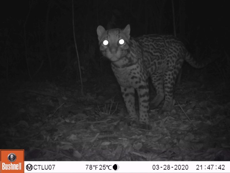
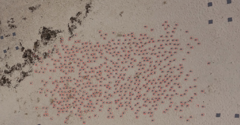
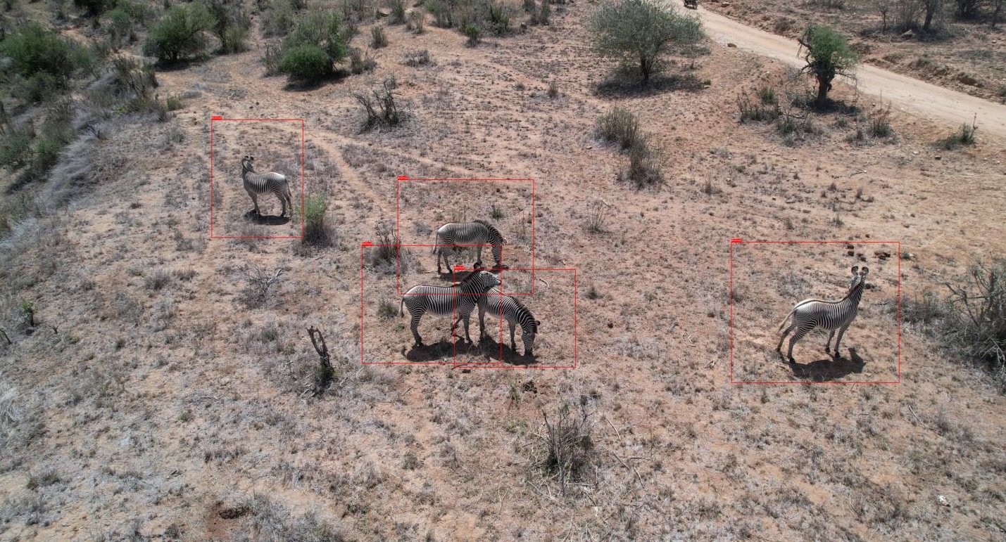
Wildlife monitoring technologies can be classified into three categories based on their ecological applications and imaging characteristics [16, Fig. 1]. Camera traps excel at capturing detailed imagery of animals but are fundamentally limited by their stationary nature and narrow field of view, constraining their utility for studying dynamic behaviors across landscapes. High-altitude aerial footage provides excellent coverage for population counts [38, 5] but only capture a few pixels per animal from nadir111Bird’s-eye view, or top-down angles, insufficient for individual identification [33] or fine-grained behavioral analysis [14]. Low-altitude drone studies (40 meters or lower) occupy a middle ground because they provide sufficient resolution (100+ pixels per animal) for behavioral analysis [34, 31], movement [21] and individual identification [7, 33] while covering larger spatial extents than camera traps. Low-altitude imagery, such as that collected by systems like WildWing [18] and WildBridge [25], presents unique challenges for object detection algorithms.
Despite advances in general object detection, standard computer vision models significantly degrade when applied to wildlife detection in drone imagery. While models like YOLO [13] achieve impressive accuracy on benchmark datasets such as MSCOCO [23], their performance degrades substantially when deployed for animal detection in varied natural environments (see Sec. 4). This performance gap presents a compelling opportunity for computer vision researchers to address real-world ecological challenges through technical innovation. Existing detection models designed for camera traps (like MegaDetector [1]) focus primarily on reducing false negatives, while models for high-altitude imagery (such as POLO [24] and HerdNeT [6]) prioritize accurate counting from minimal pixel information. No existing method addresses the specific requirements of low-altitude drone studies.
The absence of suitable training datasets has been the primary barrier to developing effective detection methods for low-altitude drone wildlife monitoring [26, 41]. Environmental variability across field sites introduces substantial domain shift, causing models trained in one location to fail when deployed in different locations. Logistical challenges have limited previous dataset development efforts, including coordinated field campaigns across multiple locations [5], complex permissions for protected areas [31], and the need for ecological expertise during annotation [34]. Our novel multi-environment, multi-species, low-altitude aerial footage dataset (MMLA) directly addresses these limitations by providing consistent high-resolution imagery across diverse locations (Ol Pejeta Conservancy and Mpala Research Centre in Kenya and The Wilds Conservation Center in Ohio) and species (Plains zebra, Grevy’s zebra, Persian onager, giraffe, African Painted Dog), enabling researchers to develop detection methods for practical ecological applications.
2 Background & Related Work
We classify animal footage into three broad categories: camera traps, low-altitude aerial footage, and high-altitude aerial footage, illustrated in Fig. 1. Camera traps capture wildlife images where animals typically appear as a larger percentage of the frame, depending on positioning and animal size [22, 11]. Low-altitude footage captures medium-count pixel images ideal for behavior and tracking studies [29, 16, 14]. High-altitude drones record footage where animals appear small within the image frame, limiting detail but covering larger areas [5, 12, 10]. Camera trap and high-altitude aerial footage datasets, while valuable, are inherently unusable for certain ecological applications. Camera trap datasets [37] are fundamentally constrained by their stationary nature and limited field of view, making them inadequate for studying dynamic social interactions and movement patterns across landscapes. High-altitude aerial footage, while excellent for population surveys and density estimation, lacks the resolution necessary for fine-grained behavioral analysis and individual identification.
Our review of existing multi-species aerial datasets, summarized in Tab. 1, highlights a critical gap in existing datasets [27]. There is no multi-species, multi-location, aerial footage dataset where the species of interest are at least 100px per animal in frame. This is a significant barrier to developing generalizable systems for mammal detection from drone datasets. While the bird detection dataset [39] has multi-location imagery of birds (24K images across 13 ecosystems), the animal size is limited (35px) and lacks mammalian species. Existing mammal datasets [8, 14, 28, 21] contain thousands of annotated samples but are geographically limited to single locations for each species, potentially creating detection models that do not transfer well across environments [4, 36]. Furthermore, the optimal resolution for advanced ecological applications, such as individual identification [33], behavioral analysis [14, 30, 21], and inter- and intra-species interaction studies [32], requires pixel sizes of approximately 100-300px per animal [20], which can only be achieved through controlled low-altitude flights that maintain consistent image quality across different terrains and lighting conditions [17, 18].
| Location | Session | Date | Total Frames | Species |
| Ol Pejeta Conservancy, Laikipia, Kenya | 1 | 1/31/25 | 16,726 | Plains zebra |
| 2 | 2/1/25 | 12,542 | Plains zebra | |
| Subtotal: | 29,268 | |||
| Mpala Research Center, Laikipia, Kenya | 1 | 1/12/23 | 16,891 | Giraffe |
| 2 | 1/17/23 | 11,165 | Plains zebra | |
| 3 | 1/18/23 | 17,940 | Grevy’s zebra | |
| 4 | 1/20/23 | 33,960 | Grevy’s zebra | |
| 5 | 1/21/23 | 24,106 | Giraffe, Plains and Grevy’s zebras | |
| Subtotal: | 104,062 | |||
| The Wilds Conservation Center, Ohio, USA | 1 | 6/14/24 | 13,749 | African Painted Dog |
| 2 | 7/31/24 | 3,436 | Giraffe | |
| 3 | 4/18/24 | 4,053 | Persian onager | |
| 4 | 7/31/24 | 506 | Grevy’s zebra | |
| Subtotal: | 21,744 | |||
| Total: | 155,074 | |||
To our knowledge, our MMLA dataset represents the first collection of low-altitude drone imagery containing the same species across multiple settings [27]. The availability of large, geographically diverse camera trap datasets, such as the LILA collection [22], has enabled the training and deployment of robust, generalizable models, such as SpeciesNet [9] and MegaDetector [1]. Manned aircraft have been used to estimate wildlife populations for decades, so high-altitude drone missions have benefited from established protocols and benchmarks for conducting such studies [5]. Several models have been developed to automatically count animal populations from high-altitude drone surveys, including POLO [24] and HerdNet [6]. Developing new computer vision models is essential to fully leveraging our cross-location, multi-species, low-altitude dataset, which uniquely bridges the gap between static camera trap data and broad high-altitude surveys. Training on diverse environments and species will produce more robust and generalizable models than those trained on single-location or single-species datasets, revolutionizing wildlife monitoring by enabling real-time behavioral analysis and dynamic tracking across varied terrains and ecological contexts.
3 MMLA Dataset
Our MMLA dataset contains annotated drone imagery used for wildlife monitoring and conservation research, which supports the development of computer vision models for animal detection and classification. MMLA contains imagery from three locations: Ol Pejeta Conservancy and Mpala Research Centre, both in Laikipia, Kenya, and The Wilds Conservation Center, in Ohio, USA. The dataset contains five species: Plains zebras, Grevy’s zebras, giraffes, Persian onagers, and African Painted Dogs. The different animal species captured in various environments allow computer vision experts to evaluate model generalizability. The dataset includes 155,074 frames, summarized in Tab. 2. Each video frame has COCO format annotations (bounding boxes with normalized coordinates) manually created using CVAT and kabr-tools [19].
The Ol Pejeta dataset contains 29,268 frames of Plains zebras from Ol Pejeta Conservancy in Kenya (January-February 2025), collected using the autonomous WildWing system [18] across seven high-resolution video sessions during the WildDrone Hackathon [40].
The Mpala dataset contains 104,062 frames of giraffes, Grevy’s zebras, and Plains zebras from Mpala Research Center in Kenya (January 2023), collected manually using a DJI Air 2S drone across five sessions as part of the Kenyan Animal Behavior Recognition (KABR) project [14].
The Wilds dataset contains 21,744 frames of African Painted Dogs, Persian Onagers, Giraffes, and Grevy’s Zebras from The Wilds Conservation Center in Ohio (April-July 2024), collected using both DJI Mini and Parrot Anafi drones, with a combination of manual and autonomous WildWing system collection [15].
4 Evaluation
| Model | Overall F1 | Giraffe F1 | Zebra F1 | |||||||||
| All | Mpala | OPC | Wilds | All | Mpala | OPC | Wilds | All | Mpala | OPC | Wilds | |
| YOLOv5m | 16.31 | 22.60 | 16.34 | 12.02 | 49.33 | 52.62 | – | 39.98 | 10.73 | 7.10 | 18.42 | 4.03 |
| YOLOv8m | 17.01 | 20.20 | 16.08 | 15.33 | 46.05 | 49.29 | – | 38.70 | 10.16 | 5.51 | 17.97 | 5.08 |
| YOLO11m | 18.55 | 21.86 | 15.52 | 17.59 | 50.89 | 54.59 | – | 41.88 | 16.08 | 4.60 | 16.36 | 42.55 |
| Model | MSCOCO (mAP50) | Overall mAP50 | Giraffe Precision | Zebra Precision | |||||||||
| All | Mpala | OPC | Wilds | All | Mpala | OPC | Wilds | All | Mpala | OPC | Wilds | ||
| YOLOv5m | 49.0 | 31.58 | 64.88 | 29.78 | 22.17 | 76.05 | 77.91 | – | 70.64 | 31.17 | 35.44 | 30.37 | 22.40 |
| YOLOv8m | 50.2 | 31.77 | 63.88 | 26.33 | 24.99 | 66.85 | 77.90 | – | 47.47 | 29.67 | 36.74 | 27.05 | 37.30 |
| YOLOv11m | 51.2 | 32.83 | 65.71 | 27.06 | 19.51 | 71.53 | 80.28 | – | 53.30 | 34.18 | 28.84 | 21.59 | 68.24 |
We evaluate the performance of three popular YOLO models—YOLOv5m, YOLOv8m, and YOLOv11m—for animal detection in the MMLA drone imagery collected across three distinct environments. The YOLO (You Only Look Once) family of models represents a popular choice for AI-driven animal ecology (ADAE) studies due to their speed, ease of use, and accuracy [13, 16]. We selected medium-sized variants to balance detection performance with computational efficiency, as ADAE studies often utilize edge devices like laptops and Raspberry Pi computers. YOLO models perform detection in a single forward pass, making them suitable for real-time applications on resource-constrained devices.
All evaluations were conducted using the pre-trained models without additional fine-tuning to assess their out-of-the-box performance on our dataset. We extracted approximately 400 frames from each session for evaluation purposes to ensure even coverage across the MMLA dataset. The evaluation subset consists of 5,073 frames, 1,050 from Ol Pejeta Conservancy, 1,923 from Mpala Research Center, and 2,100 from The Wilds Conservation Center. We assessed each model’s performance for each location using F1, Tab. 3 and mean average precision with a 50% threshold for intersection over union (mAP50), Tab. 4. We report each model’s F1 score and precision performance in detecting giraffes and zebras by location, Tab. 4. YOLOv11m achieved the best performance on the overall MMLA dataset, with an 18.55% F1 score and 32.83% mAP50 score.
5 Discussion
Our comparative analysis of YOLOv5m, YOLOv8m, and YOLO11m models across the MMLA dataset reveals interesting patterns. YOLO11m demonstrates the strongest overall performance across all datasets combined. However, performance varies significantly by location, with all models achieving substantially higher scores in the Mpala dataset (mAP50 63%) compared to the OPC and The Wilds. YOLO [13] is trained on MSCOCO [23] and might be more similar to the Mpala data compared to The Wilds and OPC, explaining the difference in performance across these locations. For specific species detection, YOLO11m excels at giraffe detection with an F1 score of 50.89%, consistently outperforming other models across datasets. Interestingly, while YOLO11m shows remarkable zebra detection capability in The Wilds dataset (42.55% F1), YOLOv5m performs better for zebra detection in the OPC dataset (18.42% F1). A mAP50 score of 33% is significantly lower than the average mAP50 score achieved by YOLOv5m, YOLOv8m, and YOLO11m of 50% on the MSCOCO dataset [13].
6 Conclusion
Our study reveals that wildlife detection performance varies significantly across environments, with YOLO11m generally outperforming other models for overall detection (32.83% mAP50) and specific species like giraffes (50.89% F1). However, the stark contrast between high performance in Mpala versus lower scores in OPC and The Wilds datasets indicates that environmental factors—likely habitat features, image quality, or animal density—substantially impact detection reliability. These findings underscore the importance of location-specific adaptation when deploying wildlife detection systems. Future work should explore fine-tuning strategies for environment-specific optimization, investigate environmental factors affecting detection performance, and consider ensemble approaches to improve robustness across diverse conservation settings. Our MMLA dataset provides a valuable benchmark for developing more generalizable animal detection algorithms for drone-based wildlife monitoring.
7 Data Availability Statement
The MMLA dataset is available on HuggingFace. The African Painted Dog data is available upon request.
References
- [1] Sara Beery, Dan Morris, and Siyu Yang. Efficient pipeline for camera trap image review. arXiv preprint arXiv:1907.06772, 2019.
- [2] Marc Besson, Jamie Alison, Kim Bjerge, Thomas E. Gorochowski, Toke T. Høye, Tommaso Jucker, Hjalte M. R. Mann, and Christopher F. Clements. Towards the fully automated monitoring of ecological communities. Ecology Letters, 25(12):2753–2775, 2022.
- [3] Elizabeth Bondi, Raghav Jain, Palash Aggrawal, Saket Anand, Robert Hannaford, Ashish Kapoor, Jim Piavis, Shital Shah, Lucas Joppa, Bistra Dilkina, and Milind Tambe. Birdsai: A dataset for detection and tracking in aerial thermal infrared videos. In WACV, 2020.
- [4] Yuhua Chen, Wen Li, Christos Sakaridis, Dengxin Dai, and Luc Van Gool. Domain adaptive faster r-cnn for object detection in the wild. In Proceedings of the IEEE conference on computer vision and pattern recognition, pages 3339–3348, 2018.
- [5] Evangeline Corcoran, Megan Winsen, Ashlee Sudholz, and Grant Hamilton. Automated detection of wildlife using drones: Synthesis, opportunities and constraints. Methods in Ecology and Evolution, 12(6):1103–1114, 2021.
- [6] Alexandre Delplanque, Samuel Foucher, Jérôme Théau, Elsa Bussière, Cédric Vermeulen, and Philippe Lejeune. From crowd to herd counting: How to precisely detect and count african mammals using aerial imagery and deep learning? ISPRS Journal of Photogrammetry and Remote Sensing, 197:167–180, 2023.
- [7] Brinky Desai, Arpitkumar Patel, Vaishwi Patel, Supan Shah, Mehul S Raval, and Ratna Ghosal. Identification of free-ranging mugger crocodiles by applying deep learning methods on uav imagery. Ecological Informatics, 72:101874, 2022.
- [8] Jasper A.J. Eikelboom, Jelle Wind, Evert van de Ven, Lizzie M. Kenana, Bennet Schroder, Henrik J. de Knegt, Frank van Langevelde, and Herbert H.T. Prins. Improving the precision and accuracy of animal population estimates with aerial image object detection. Methods in Ecology and Evolution, 10(11):1875–1887, 2019.
- [9] Tomer Gadot, Ștefan Istrate, Hyungwon Kim, Dan Morris, Sara Beery, Tanya Birch, and Jorge Ahumada. To crop or not to crop: Comparing whole-image and cropped classification on a large dataset of camera trap images. IET Computer Vision, 18(8):1193–1208, 2024.
- [10] Madeline C Hayes, Patrick C Gray, Guillermo Harris, Wade C Sedgwick, Vivon D Crawford, Natalie Chazal, Sarah Crofts, and David W Johnston. Drones and deep learning produce accurate and efficient monitoring of large-scale seabird colonies. Ornithological Applications, 123(3):duab022, Aug. 2021.
- [11] Wentong He, Ze Luo, Xinyu Tong, Xiaoyi Hu, Can Chen, and Zufei Shu. Long-tailed metrics and object detection in camera trap datasets. Applied Sciences, 13(10), 2023.
- [12] Jarrod C. Hodgson, Rowan Mott, Shane M. Baylis, Trung T. Pham, Simon Wotherspoon, Adam D. Kilpatrick, Ramesh Raja Segaran, Ian Reid, Aleks Terauds, and Lian Pin Koh. Drones count wildlife more accurately and precisely than humans. Methods in Ecology and Evolution, 9(5):1160–1167, 2018.
- [13] Glenn Jocher, Jing Qiu, and Ayush Chaurasia. Ultralytics YOLO.
- [14] Maksim Kholiavchenko, Jenna Kline, Michelle Ramirez, Sam Stevens, Alec Sheets, Reshma Babu, Namrata Banerji, Elizabeth Campolongo, Matthew Thompson, Nina Van Tiel, et al. Kabr: In-situ dataset for kenyan animal behavior recognition from drone videos. In Proceedings of the IEEE/CVF Winter Conference on Applications of Computer Vision, pages 31–40, 2024.
- [15] Jenna Kline. Wildwing system deployment data. https://zenodo.org/records/14838101, 2025.
- [16] Jenna Kline, Austin O’Quinn, Tanya Berger-Wolf, and Christopher Stewart. Characterizing and modeling ai-driven animal ecology studies at the edge. In 2024 IEEE/ACM Symposium on Edge Computing (SEC), pages 220–233. IEEE, 2024.
- [17] Jenna Kline, Christopher Stewart, Tanya Berger-Wolf, Michelle Ramirez, Samuel Stevens, Reshma Ramesh Babu, Namrata Banerji, Alec Sheets, Sowbaranika Balasubramaniam, Elizabeth Campolongo, Matthew Thompson, Charles V. Stewart, Maksim Kholiavchenko, Daniel I. Rubenstein, Nina Van Tiel, and Jackson Miliko. A framework for autonomic computing for in situ imageomics. In 2023 IEEE International Conference on Autonomic Computing and Self-Organizing Systems (ACSOS), page 11–16, Toronto, ON, Canada, Sept. 2023. IEEE.
- [18] Jenna Kline, Alison Zhong, Kevyn Irizarry, Charles V Stewart, Christopher Stewart, Daniel I Rubenstein, and Tanya Berger-Wolf. Wildwing: An open-source, autonomous and affordable uas for animal behaviour video monitoring. Methods in Ecology and Evolution, 2025.
- [19] Jenna Kline, Alison Zhong, Maksim Kholiavchenko, and Elizabeth Campolongo. kabr-tools: Tools for working with data for annotating animal behavior, 2024.
- [20] Jenna M Kline, Maksim Kholiavchenko, Otto Brookes, Tanya Berger-Wolf, Charles V Stewart, and Christopher Stewart. Integrating biological data into autonomous remote sensing systems for in situ imageomics: A case study for kenyan animal behavior sensing with unmanned aerial vehicles (uavs). arXiv preprint arXiv:2407.16864, 2024.
- [21] Benjamin Koger, Adwait Deshpande, Jeffrey T. Kerby, Jacob M. Graving, Blair R. Costelloe, and Iain D. Couzin. Quantifying the movement, behaviour and environmental context of group-living animals using drones and computer vision. Journal of Animal Ecology, n/a(n/a), 2022.
- [22] LILA BC. Lila bc: Labeled information library of alexandria: Biology and conservation. https://lila.science/, 2025. Accessed on March 24, 2025.
- [23] Tsung-Yi Lin, Michael Maire, Serge Belongie, Lubomir Bourdev, Ross Girshick, James Hays, Pietro Perona, Deva Ramanan, C. Lawrence Zitnick, and Piotr Dollár. Microsoft coco: Common objects in context, 2015.
- [24] Giacomo May, Emanuele Dalsasso, Benjamin Kellenberger, and Devis Tuia. Polo–point-based, multi-class animal detection. arXiv preprint arXiv:2410.11741, 2024.
- [25] Kilian Meier, Arthur Richards, Matthew Watson, Caspian Johnson, Duncan Hine, Tom Richardson, and Guy Maalouf. Wildbridge: Conservation software for animal localisation using commercial drones. In T. Richardson, editor, 15th annual International Micro Air Vehicle Conference and Competition, page 324–333, Bristol, United Kingdom, 2024. Paper no. IMAV2024-39.
- [26] Payal Mittal, Raman Singh, and Akashdeep Sharma. Deep learning-based object detection in low-altitude uav datasets: A survey. Image and Vision computing, 104:104046, 2020.
- [27] Dan Morris. Datasets with annotated wildlife in drone/aerial images - publicly available datasets. https://github.com/agentmorris/agentmorrispublic/blob/main/drone-datasets.md#publicly-available-datasets, 2024.
- [28] Chao Mou, Tengfei Liu, Chengcheng Zhu, and Xiaohui Cui. Waid: A large-scale dataset for wildlife detection with drones. Applied Sciences, 13(1818):10397, Jan. 2023.
- [29] Chao Mou, Chengcheng Zhu, Tengfei Liu, and Xiaohui Cui. A novel efficient wildlife detecting method with lightweight deployment on uavs based on yolov7. IET Image Processing, 18(5):1296–1314, 2024.
- [30] Katalin Ozogány, Viola Kerekes, Attila Fülöp, Zoltán Barta, and Máté Nagy. Fine-scale collective movements reveal present, past and future dynamics of a multilevel society in przewalski’s horses — nature communications. Nature Communications, 14(1):5096, Sept. 2023.
- [31] Lucia Pedrazzi, Hemal Naik, Chris Sandbrook, Miguel Lurgi, Ines Fürtbauer, and Andrew J. King. Advancing animal behaviour research using drone technology. Animal Behaviour, 222:123147, Apr. 2025.
- [32] Lucia Pedrazzi, Hemal Naik, Chris Sandbrook, Miguel Lurgi, Ines Fürtbauer, and Andrew J. King. Advancing animal behaviour research using drone technology. Animal Behaviour, 222:123147, Apr. 2025.
- [33] Edouard Rolland, Kasper Grøntved, Lucie Laporte-Devylder, Jenna Kline, Ulrik Lundquist, and Anders Christensen. Drone swarms for animal monitoring: A method for collecting high-quality multi-perspective data. In T. Richardson, editor, 15th annual International Micro Air Vehicle Conference and Competition, pages 316–323, Bristol, United Kingdom, Sep 2024. Paper no. IMAV2024-38.
- [34] Lukas Schad and Julia Fischer. Opportunities and risks in the use of drones for studying animal behaviour. Methods in Ecology and Evolution, 14(8):1864–1872, 2023.
- [35] Devis Tuia, Benjamin Kellenberger, Sara Beery, Blair R Costelloe, Silvia Zuffi, Benjamin Risse, Alexander Mathis, Mackenzie W Mathis, Frank Van Langevelde, Tilo Burghardt, et al. Perspectives in machine learning for wildlife conservation. Nature communications, 13(1):792, 2022.
- [36] Vidit Vidit, Martin Engilberge, and Mathieu Salzmann. Clip the gap: A single domain generalization approach for object detection. In Proceedings of the IEEE/CVF conference on computer vision and pattern recognition, pages 3219–3229, 2023.
- [37] Juliana Vélez, William McShea, Hila Shamon, Paula J. Castiblanco-Camacho, Michael A. Tabak, Carl Chalmers, Paul Fergus, and John Fieberg. An evaluation of platforms for processing camera-trap data using artificial intelligence. Methods in Ecology and Evolution, 14(2):459–477, 2023.
- [38] Dongliang Wang, Quanqin Shao, and Huanyin Yue. Surveying wild animals from satellites, manned aircraft and unmanned aerial systems (uass): A review. Remote Sensing, 11(1111):1308, Jan. 2019.
- [39] Ben Weinstein, Lindsey Garner, Vienna R. Saccomanno, Ashley Steinkraus, Andrew Ortega, Kristen Brush, Glenda Yenni, Ann E. McKellar, Rowan Converse, Christopher D. Lipitt, Alex Wegmann, Nick D. Holmes, Alice J. Edney, Tom Hart, Mark J. Jessopp, Rohan Clarke, Dominik Markowski, Henry Senyondo, Ryan Dotson, Ethan P. White, Peter Frederick, and S.K Morgan Ernest. A global model of bird detection in high resolution airborne images using computer vision, June 2021.
- [40] WildDrone EU Consortium. Wilddrone eu project, 2025. Accessed: 03-Apr-2025.
- [41] Pengfei Zhu, Longyin Wen, Xiao Bian, Haibin Ling, and Qinghua Hu. Vision meets drones: A challenge. arXiv preprint arXiv:1804.07437, 2018.