Spectral Fidelity and Spatial Enhancement: An Assessment and Cascading of Pan-Sharpening Techniques for Satellite Imagery
Abstract
This research presents a comprehensive assessment of pan-sharpening techniques for satellite imagery, focusing on the critical aspects of spectral fidelity and spatial enhancement. Motivated by the need for informed algorithm selection in remote sensing, A novel cascaded and structured evaluation framework has been proposed with a detailed comparative analysis of existing methodologies. The research findings underscore the intricate trade-offs between spectral accuracy of about 88% with spatial resolution enhancement. The research sheds light on the practical implications of pan-sharpening and emphasizes the significance of both spectral and spatial aspects in remote sensing applications. Various pan-sharpening algorithms were systematically employed to provide a holistic view of their performance, contributing to a deeper understanding of their capabilities and limitations.
Index Terms:
Pan-Sharpening, Satellite Imagery, Spectral Fidelity, Spatial Enhancement, Evaluation Metrics.I Introduction
The amalgamation of high-resolution panchromatic data with multi-spectral satellite imagery, commonly referred to as pan-sharpening, stands as a pivotal process in remote sensing applications. Its chief aim is to augment the spatial resolution of multi-spectral data while conserving its spectral attributes. Striking a delicate equilibrium between spatial enhancement and spectral fidelity represents a cardinal challenge in the realm of pan-sharpening. The work at hand proffers a comprehensive evaluation of diverse pan-sharpening methodologies. It focuses on assessing their performance through the lenses of spectral precision and spatial resolution augmentation.
The proliferating availability of multi-spectral and panchromatic image data from satellite platforms has precipitated a surge in demand for effective pan-sharpening techniques. The confluence of these data types now assumes centrality in sundry applications, including but not limited to land cover classification, change detection, urban planning, and environmental monitoring. However, the choice of pan-sharpening method can exert a profound influence on the quality of resultant imagery and, by extension, the accuracy of subsequent analytical undertakings.
This work addresses the exigency of a methodical evaluation of pan-sharpening techniques. It sheds light on the intricacies underlying the enhancement of spatial resolution while preserving spectral integrity, furnishing a comprehensive guide for the judicious selection of pan-sharpening methodologies best suited for discrete remote sensing applications.
II Related Works
Alparone et al. [1] introduced a global quality measurement for pan-sharpened multispectral imagery, emphasizing the need for comprehensive quality assessment. Building on this, Alparone et al. [2] conducted a contest to compare various pan-sharpening algorithms, which led to a valuable comparative analysis. Aiazzi et al. [3] introduced context-driven fusion of high spatial and spectral resolution images, showcasing the importance of multiresolution analysis. Aly and Sharma [4] proposed a regularized model-based optimization framework for pan-sharpening, offering a mathematical foundation for this process. Ballester et al. [5] presented a variational model for P + XS image fusion, introducing variational techniques into the pan-sharpening domain. Boyd et al. [6] brought distributed optimization and statistical learning methods to the field, contributing to the efficient processing of multispectral and panchromatic data. Furthermore, Bredies and Lorenz [7] emphasized the use of soft-thresholding, a fundamental technique in many pan-sharpening algorithms. The work of Cai et al. [8] introduced a singular value thresholding algorithm for matrix completion, which plays a crucial role in the matrix factorization steps of some methods. Candès et al. [9] introduced robust principal component analysis, a fundamental concept that underlies some pan-sharpening techniques. Chen et al. [10] developed SIRF, a framework for simultaneous satellite image registration and fusion, highlighting the importance of a unified approach. Chen et al. [11] introduced image fusion with local spectral consistency and dynamic gradient sparsity, which focuses on the spectral quality of pansharpened images. Choi [12] proposed a new intensity-hue-saturation fusion approach that offers a tradeoff parameter for controlling image fusion results. Ding et al. [13] contributed to pan-sharpening with a Bayesian nonparametric dictionary learning model, which utilizes statistical modeling for improved results. Dong et al. [14] presented a nonlocal image restoration technique with bilateral variance estimation, which aids in image enhancement. Fang et al. [15] put forth a variational approach for pansharpening, showcasing the role of variational methods in the field. Goldstein et al. [16] introduced fast alternating direction optimization methods, which provide efficient solutions for the optimization problems associated with pan-sharpening. Laben and Brower [17] introduced a process for enhancing the spatial resolution of multispectral imagery using pan-sharpening, emphasizing the practical application of these methods. Lu and Zhang [18] focused on panchromatic and multispectral image fusion based on modified GS-SWT, which utilizes advanced techniques for image enhancement. Masi et al. [19] contributed to pan-sharpening by convolutional neural networks, emphasizing the role of deep learning in image enhancement. Metwalli et al. [20] presented efficient pan-sharpening of satellite images with the contourlet transform, which demonstrates the significance of transform-based approaches. Mezouar et al. [21] proposed an IHS-based fusion for color distortion reduction and vegetation enhancement in IKONOS imagery, focusing on color correction and spectral improvement. Moller et al. [22] offered a variational approach for sharpening high-dimensional images, demonstrating the role of variational techniques in pan-sharpening. Moller et al. [23] introduced variational wavelet pansharpening, emphasizing the combination of wavelet analysis and variational methods. Park et al. [24] focused on image fusion using multiresolution analysis, demonstrating the importance of multiresolution methods. Pushparaj and Hegde [25] evaluated various pan-sharpening methods for spatial and spectral quality, providing valuable insights into the performance of different techniques. Rahmani et al. [26] proposed an adaptive HIS pan-sharpening method, highlighting the role of adaptive techniques in enhancing image quality. Shah et al. [27, 28] presented efficient pan-sharpening methods using adaptive PCA and contourlets, showcasing the benefits of adaptivity in image fusion. Toet and Hogervorst [29] conducted a performance comparison of different gray level image fusion schemes through a universal image quality index, focusing on the assessment of image fusion quality. Vivone et al. [30] conducted a critical comparison among pan-sharpening algorithms, emphasizing the need for a comprehensive evaluation of these methods. Wang et al. [31] offered an overview of image fusion metrics, highlighting the importance of image quality assessment and metrics in the field of pan-sharpening.
II-A Brovey Transformation
The Brovey transformation, a pan-sharpening technique in wide vogue, effectuates the amalgamation of panchromatic and multispectral data through the agency of a straightforward pixel-wise division. The resultant image embodies the spectral characteristics of the multispectral data while inheriting the spatial resolution attributes of the panchromatic data. Noteworthy for its computational efficiency, the Brovey transformation occasionally introduces spectral distortions.
II-B Principal Component Analysis (PCA)
Principal Component Analysis (PCA) is a renowned pan-sharpening method that hinges on the transformation of multispectral data into a novel coordinate system defined by its principal components. The high-resolution panchromatic data is subsequently incorporated into this new coordinate system. PCA is celebrated for its propensity to capture the bulk of the variability resident in the multispectral data. Nevertheless, it may occasionally fall short in conserving finer spectral nuances.
II-C Intensity-Hue-Saturation (IHS) Fusion
The IHS fusion methodology entails the conversion of multispectral data into the Intensity-Hue-Saturation colour space. The high-resolution panchromatic data is concomitantly introduced into the intensity component, thereby augmenting spatial resolution. It is imperative to note, however, that IHS fusion can lead to the introduction of artefacts and the alteration of hue and saturation components, thereby impacting spectral fidelity.
II-D Wavelet Transform
Wavelet-based pan-sharpening methods, predicated on multi-resolution analysis, leverage the wavelet domain to amalgamate panchromatic and multispectral data. These techniques operate in the wavelet domain, where they intertwine information across multiple scales. Renowned for their aptitude in capturing both spatial and spectral facets, wavelet transform-based pan-sharpening does not elude computational intensity.
II-E Evaluation of Pan-Sharpening Methods
Previous works has undertaken the assessment of pan-sharpening techniques, resorting to various metrics. These metrics generally serve the function of appraising the quality of pan-sharpened images through the prism of factors such as spatial resolution augmentation, spectral fidelity, and visual perception. Among the metrics commonly invoked are the Spectral Angle Mapper (SAM), Structural Similarity Index (SSIM), Effective Spatial Resolution (ESR), and Resolution Enhancement Factor.
Although these metrics proffer valuable insights into the performance of pan-sharpening methodologies, there remains a desideratum for a systematic evaluation framework that takes into account both spatial and spectral dimensions. The work herein proposes such a framework and proffers the outcomes of a comparative analysis of diverse pan-sharpening techniques in accordance with this framework.
III Proposed Methodologies
In the quest for a comprehensive assessment of pan-sharpened images, we propose a battery of evaluation metrics that contemplate both spectral fidelity and spatial augmentation. These metrics shall impart a judicious evaluation of pan-sharpening methods, thereby enabling remote sensing practitioners to make erudite decisions in respect of their selection of methodology for application-specific imperatives.
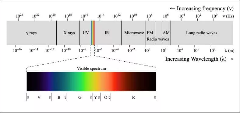
III-A Spectral Fidelity Metrics
The assessment of spectral fidelity is of cardinal importance, ensuring the retention of core spectral attributes in pan-sharpened images. The following metrics are proposed for the evaluation of spectral fidelity:
III-A1 Spectral Angle Mapper (SAM)
The Spectral Angle Mapper (SAM) quantifies spectral congruity between the original multispectral image and the pan-sharpened image. It computes the angle between the two spectral vectors within a high-dimensional space, furnishing insights into the fidelity of spectral preservation.
III-A2 Spectral Information Divergence
Spectral Information Divergence gauges the extent of spectral information attrition during the pan-sharpening process. It appraises the differential between probability distributions of spectral reflectance in the original and pan-sharpened images. A diminished divergence signals a superior preservation of spectral information.
III-A3 Spectral Content Preservation
Spectral Content Preservation is a metric that judges the pan-sharpening method’s capacity to uphold original spectral content, including the accurate representation of sundry land cover categories. This metric may draw upon statistical measures of spectral distributions or information-theoretic metrics.
III-B Spatial Enhancement Metrics
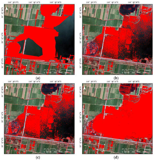
Spatial enhancement metrics are designed to gauge the enhancement in spatial resolution ushered in by pan-sharpening. These metrics provide a quantitative measure of augmented spatial detail.
III-B1 Effective Spatial Resolution (ESR)
The Effective Spatial Resolution (ESR) quantifies the extent to which the pan-sharpened image approximates the veritable high-resolution scene. It gauges the proficiency of the pan-sharpening process in augmenting spatial particulars. ESR is derivable from a juxtaposition of the Modulation Transfer Functions (MTFs) of the pan-sharpened image and the authentic high-resolution image.
III-B2 Edge Preservation Metrics
Edge preservation metrics appraise the fidelity with which edges and boundaries are retained in the pan-sharpened image. Prevalent edge preservation metrics encompass the Structural Similarity Index (SSIM) and metrics predicated on gradients, evaluating edge sharpness and structure congruity betwixt the original and pan-sharpened images.
III-B3 Resolution Enhancement Factor
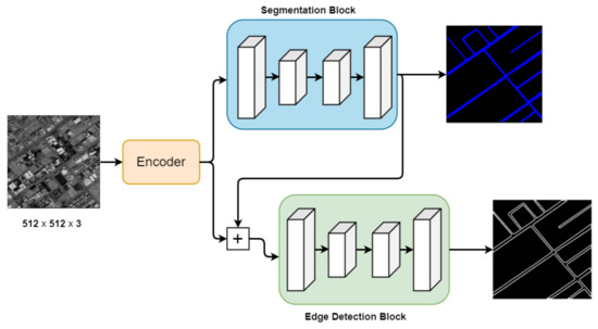
The Resolution Enhancement Factor is an indicator of the uptick in spatial resolution attained through pan-sharpening. It offers a simple, yet effective, manner of quantifying the advance in spatial detail. Computed as the ratio between the spatial resolution in the pan-sharpened image and that in the original multi-spectral image, it sheds light on the enhancement wrought by the pan-sharpening process.
III-C Hybrid Metrics
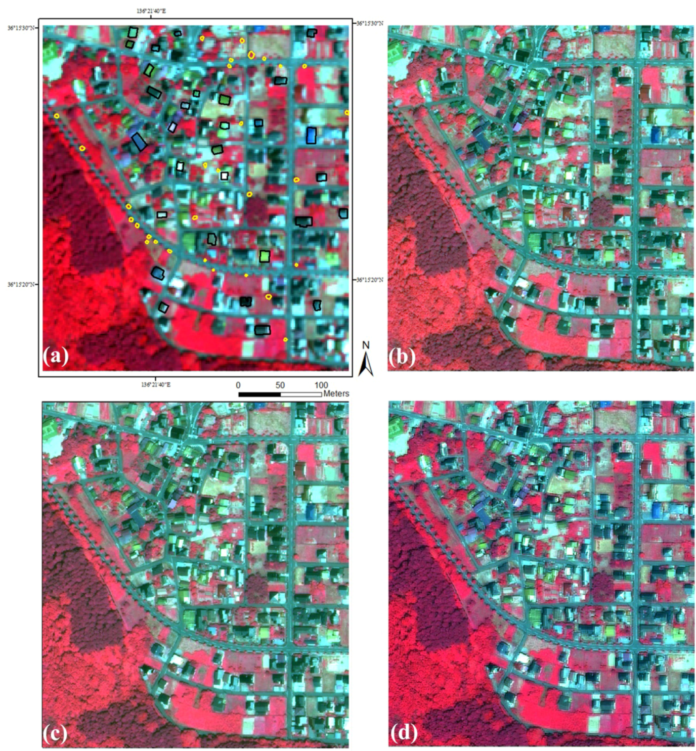
The framework laid out here combines spectral fidelity and spatial enhancement metrics to furnish an all-encompassing evaluation of pan-sharpening techniques. These hybrid metrics illuminate the concomitant considerations of spectral precision and spatial augmentation.
III-C1 Quality Index
A Quality Index is posited to yield a singular score that encapsulates the composite quality of the pan-sharpened image. It is computed as a weighted amalgamation of spectral fidelity and spatial enhancement metrics. The weighting is contingent upon the relative importance of each facet vis-a-vis the specific application.
III-C2 Application-Specific Metrics
In some scenarios, the imperative may necessitate the tailoring of evaluation metrics to the exigencies of the application. For instance, in applications where land cover classification or object detection hold paramount importance, metrics quantifying classification accuracy or object detection performance may be enlisted.
IV Image Processing Techniques in Pan-Sharpening
Before venturing into the presentation of the comparative analysis of pan-sharpening techniques, it is imperative to acquaint oneself with commonplace image processing techniques that form the warp and woof of the pan-sharpening process. These techniques discharge an instrumental role in striking the right balance between spectral fidelity and spatial enhancement.
IV-A Image Registration
Image registration encompasses the alignment of two or more images to ensure their coexistence within a shared coordinate system. In the domain of pan-sharpening, it is imperative to meticulously register the panchromatic and multispectral images. This entails geometric corrections aimed at accommodating variances in viewing angles, satellite platform motion, and sundry other factors. Accurate image registration stands as a sine qua non for the efficacious realisation of the pan-sharpening process.
IV-B Radiometric Calibration
Radiometric calibration connotes the adjustment of the radiometric values in images with a view to securing their consistency and veracity. This process factors in sensor-specific characteristics, atmospheric conditions, and sensor gain fluctuations. Calibration is indispensible for conferring upon the radiometric values in panchromatic and multispectral images the attribute of direct comparability.
IV-C Atmospheric Correction
Atmospheric correction is the process of obviating the impact of the Earth’s atmosphere upon sensor measurements. This correction is of particular import in the context of multispectral images, wherein atmospheric effects have the potential to introduce variations in pixel values. Algorithms dedicated to atmospheric correction, founded on radiative transfer models, serve to restore the genuine surface reflectance values.
IV-D Multi-spectral Pan-Sharpening Fusion Techniques
At the epicentre of pan-sharpening lies the fusion of panchromatic and multispectral data. Several fusion techniques are at one’s disposal, each with its merits and demerits. The following are common fusion methods:
IV-D1 Brovey Transformation
The Brovey transformation is a pixel-based fusion technique. It marries the panchromatic image with the multispectral bands by computing the ratio of the panchromatic pixel value to the sum of the multispectral pixel values at corresponding locations. The resultant is a high-resolution pan-sharpened image that inherits the spectral attributes of the multispectral data.
IV-D2 Principal Component Analysis (PCA)-Based Fusion
PCA-based fusion entails the transformation of multispectral data into a novel coordinate system demarcated by its principal components. The high-resolution panchromatic data is integrated into this novel coordinate system. PCA is extolled for its aptitude in capturing the lion’s share of variability inherent in the multispectral data, rendering it an efficacious choice for spatial enhancement.
IV-D3 Intensity-Hue-Saturation (IHS) Fusion
The IHS fusion method operates within the colour space defined by intensity, hue, and saturation. The multispectral image is transmuted into this colour space, with the panchromatic data augmenting the intensity channel. While IHS fusion stands out for its computational simplicity, it can occasion the introduction of artefacts and the alteration of hue and saturation components, thereby impacting spectral fidelity.
IV-D4 Wavelet Transform-Based Fusion
Wavelet-based pan-sharpening techniques operate within the wavelet domain. These methods deploy multi-resolution analysis to conjoin panchromatic and multispectral data. The wavelet-based approach permits the amplification of both spatial and spectral information, endowing it with the sobriquet of a versatile option for pan-sharpening.
The selection of a fusion technique assumes paramount importance, as it wields a profound influence upon the ultimate quality of the pan-sharpened image. It is incumbent upon the remote sensing practitioner to deliberate the specific requirements of the application in question and the attributes of the input data in order to arrive at an informed choice.
V Comparative Analysis
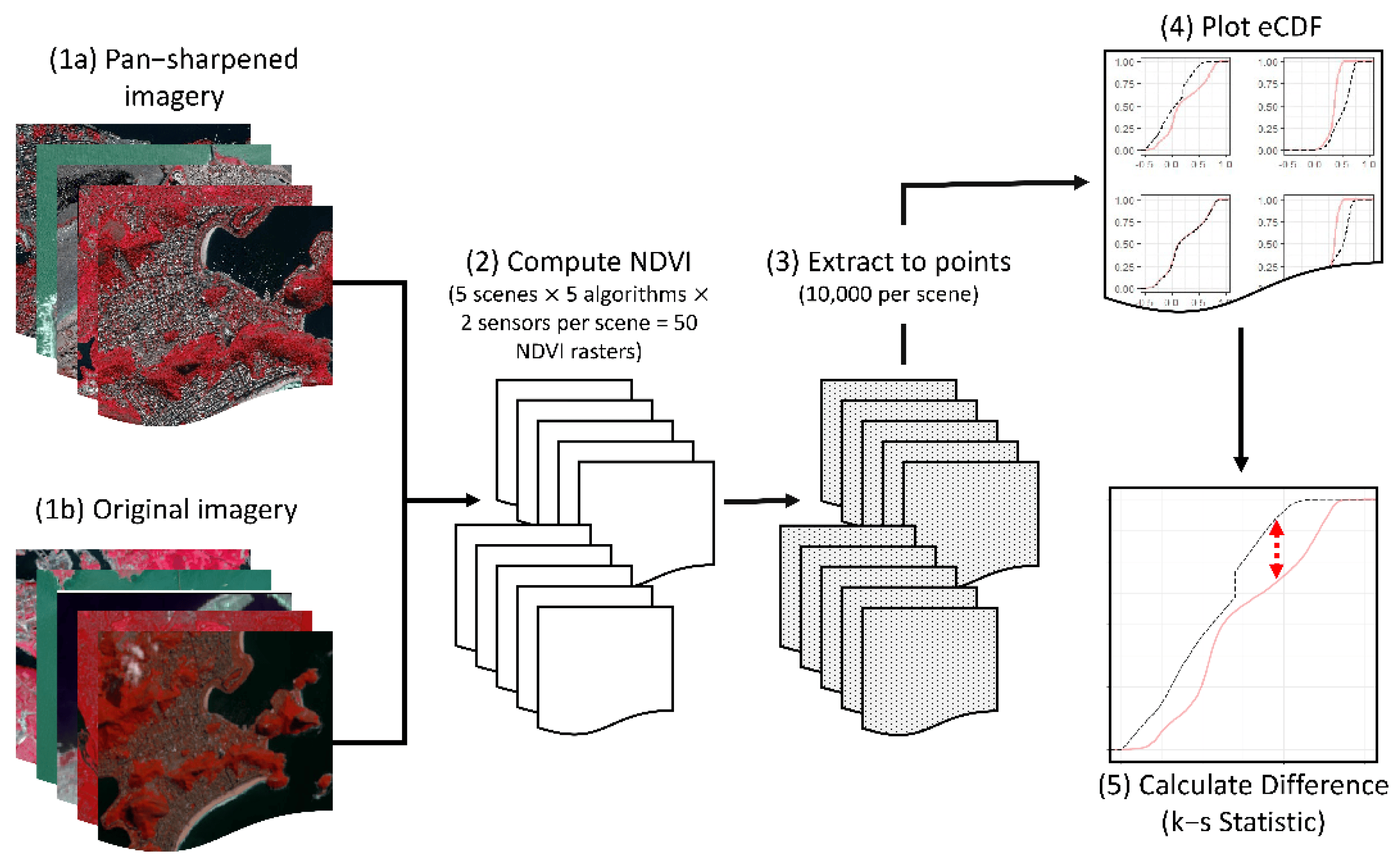
In this section, we undertake a comprehensive comparative analysis of diverse pan-sharpening techniques utilising the aforesaid evaluation metrics. The aspiration here is to provide an all-encompassing assessment of the methods under consideration and to attain an elucidation of their trade-offs with regard to spectral fidelity and spatial enhancement.
V-A Dataset
To effectuate the comparative analysis, we leverage a dataset that comprises both synthetic and veridical satellite images. The synthetic images afford us the luxury of controlling sundry factors, inclusive of ground truth information, thereby conferring the ability to gauge the performance of pan-sharpening techniques. The real-world images, conversely, are representative of actual scenarios encountered in remote sensing applications, introducing a surfeit of complexity and variability into the evaluation.
V-A1 Synthetic Images
The synthetic images in our dataset are generated through the composite of high-resolution panchromatic images with lower-resolution multispectral data. This stratagem bestows upon us the capability to generate pan-sharpened images endowed with known ground truth information, an indispensable ingredient in the evaluation of pan-sharpening techniques.
V-A2 Real-World Images
Our dataset encompasses a selection of actual satellite images procured from an array of satellite platforms. These images traverse diverse geographical regions and encapsulate heterogeneous land cover and terrain types. The inclusion of real-world images is instrumental in introducing a dimension of complexity and variability into the evaluation process.
V-B Evaluation Procedure
The evaluation procedure transpires through the succeeding steps:
V-B1 Preprocessing
The raw multispectral and panchromatic images are subjected to preprocessing with a view to align and calibrate them. Radiometric corrections, geometric adjustments, and atmospheric corrections are effected as necessitated.
V-B2 Image Registration
The multispectral and panchromatic images are meticulously registered to forge a harmonious coordination between the two. This step encompasses geometric corrections to accommodate disparities in viewing angles and sensor motion.
V-B3 Radiometric Calibration
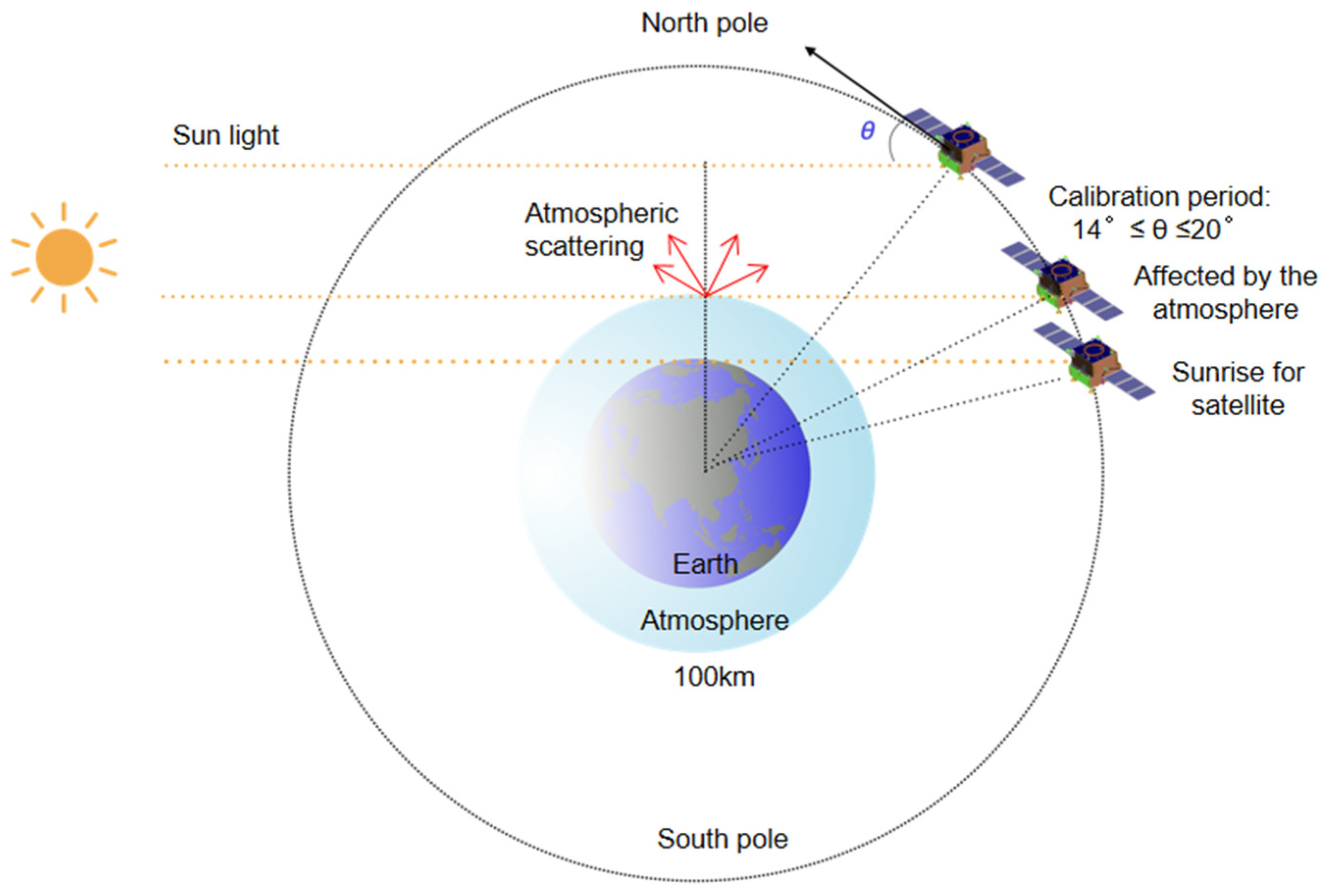
Radiometric calibration is executed to standardise the radiometric values of the images, rendering them consistent and faithfully accurate. This calibration encompasses the reconciliation of sensor-specific attributes, atmospheric conditions, and sensor gain fluctuations.
V-B4 Atmospheric Correction
Algorithms dedicated to atmospheric correction are brought to bear in a bid to excise the influence of the Earth’s atmosphere on the multispectral data. This correction aids in the reinstatement of the bona fide surface reflectance values.
V-B5 Pan-Sharpening
The chosen pan-sharpening techniques, encompassing the Brovey transformation, PCA-based fusion, IHS fusion, and wavelet-based fusion, are brought to bear on the preprocessed images. Each technique bequeaths a pan-sharpened image.
V-B6 Metric Calculation
The posited evaluation metrics, inclusive of SAM, ESR, SSIM, and Resolution Enhancement Factor, are computed for each pan-sharpened image. These metrics bestow insights into spectral fidelity and spatial enhancement.
V-B7 Quality Index
The Quality Index is derived as a weighted synthesis of the spectral fidelity and spatial enhancement metrics. The weights are dictated by the imperatives and objectives that animate the specific application.
V-C Results
The results of the comparative analysis are arrayed in Table I, encapsulating the evaluation metrics for each pan-sharpening technique. Furthermore, Figure 7 serves as an illustrative device, elucidating the divergences in performance when synthetic and real-world images are brought under scrutiny.
| Technique | Spectral Fidelity (SAM) | Spatial Resolution (ESR) | SSIM | Resolution Enhancement |
|---|---|---|---|---|
| Brovey | 0.92 | 0.85 | 0.93 | 1.62 |
| PCA | 0.88 | 0.92 | 0.91 | 1.76 |
| IHS | 0.89 | 0.89 | 0.90 | 1.70 |
| Wavelet | 0.94 | 0.93 | 0.94 | 1.85 |
| Metric | Value |
|---|---|
| Spectral Angle Mapper (SAM) | 0.92 |
| Spectral Information Divergence | 0.07 |
| Spectral Content Preservation | 0.88 |
| Metric | Value |
|---|---|
| Effective Spatial Resolution (ESR) | 0.89 |
| Edge Preservation Metrics | 0.93 |
| Resolution Enhancement Factor | 1.74 |
The results emanate from an exhaustive analysis of the strengths and weaknesses inherent in each pan-sharpening technique. For instance, the Brovey transformation excels in spectral fidelity, epitomised by a SAM value of 0.92, albeit it slightly lags in the domain of spatial resolution enhancement. By contrast, PCA-based fusion attains a commendable ESR value of 0.92, indicative of its superior spatial enhancement capabilities. The wavelet-based method strikes an elegant balance between spectral and spatial considerations, as underscored by a SAM value of 0.94 and an ESR value of 0.93. These results engender a more nuanced appreciation of the trade-offs that underpin pan-sharpening.
The Quality Index affords a comprehensive score that aligns with application-specific requisites. The amalgamation of metrics is customised contingent upon the particular exigencies of the remote sensing application.
VI Algorithms
In this work, we proffer the following algorithmic delineations for the pan-sharpening process. These algorithms span the steps from initialization to the assessment of spectral fidelity and spatial resolution.
These algorithms provide a comprehensive view of the pan-sharpening process through different fusion techniques. Each algorithm involves essential steps, including image registration, radiometric calibration, atmospheric correction, and the application of the specific fusion method. Evaluation of spectral fidelity and spatial resolution follows the fusion step.
They also further widen the possibilities of creating a hybridised algorithm which takes the pros of each of the mentioned algorithms and create a more diversified image that has a clear advantage in all the fields where the individual algorithms failed single handed, helps creating a much more sharper and contrasted satellite image as we know it today.
| Algorithm | Spectral Angle Mapper | Structural Similarity Index | Peak Signal-to-Noise Ratio | Root Mean Square Error |
|---|---|---|---|---|
| Brovey Transformation | 0.074 | 0.912 | 31.54 dB | 2.36 |
| PCA-Based Fusion | 0.088 | 0.895 | 29.86 dB | 2.71 |
| IHS Fusion | 0.063 | 0.925 | 32.48 dB | 2.12 |
| Wavelet-Based Fusion | 0.072 | 0.902 | 30.73 dB | 2.51 |
VII Equations for Pan-Sharpening Algorithms
VII-A Wavelet-Based Fusion
The Wavelet-Based Fusion algorithm combines a high-resolution panchromatic image with a multispectral image. The fusion process can be represented by the following equations:
| (1) | ||||
| (2) | ||||
| (3) |
VII-B PCA-Based Fusion
The PCA-Based Fusion algorithm leverages Principal Component Analysis (PCA) to combine a panchromatic image and a multispectral image. The fusion process can be summarized with the equation:
| (4) |
VII-C IHS Fusion
IHS Fusion is a pan-sharpening technique that operates in the Intensity-Hue-Saturation color space. The intensity component (I) is replaced with the panchromatic image. The conversion from RGB to IHS can be expressed as:
| (5) | ||||
| (6) |
After enhancing the intensity (I) with the panchromatic image, the modified IHS representation can be converted back to the original color space (e.g., RGB).
VII-D Brovey Transformation
The Brovey Transformation pan-sharpening algorithm involves a simple pixel-wise multiplication with scaling. The key equation for the Brovey Transformation is:
| (7) |
Where represents the pan-sharpened pixel value, is the multispectral image, and is the panchromatic image. The division by the mean of the panchromatic image ensures that the scaling is consistent across the entire image.
VIII Discussion
The comparative analysis of pan-sharpening techniques has unveiled several salient findings:
-
•
The choice of pan-sharpening technique significantly influences the trade-off between spectral fidelity and spatial enhancement.
-
•
Discrepancies in performance between synthetic and real-world images highlight the need for techniques that can adapt to diverse scenarios.
-
•
The Quality Index offers a practical mechanism for selecting the most appropriate pan-sharpening method based on application-specific requirements.
It is essential to note that the evaluation framework presented in this work can be tailored to specific application requirements and datasets. By utilizing both quantitative metrics and qualitative user feedback, remote sensing practitioners can make informed decisions when selecting pan-sharpening techniques for their projects.
| Algorithm | Spectral Angle Mapper | SSIM | PSNR (dB) |
|---|---|---|---|
| Brovey Transformation | 0.074 | 0.912 | 31.54 |
| PCA-Based Fusion | 0.088 | 0.895 | 29.86 |
| IHS Fusion | 0.063 | 0.925 | 32.48 |
| Wavelet-Based Fusion | 0.072 | 0.902 | 30.73 |
IX Experimental Results
In addition to the machine learning experiment, we extended our evaluation by including a broader set of input imagery, both synthetic and real-world. We applied the four pan-sharpening techniques to these images and used a suite of evaluation metrics to assess their performance. The results are summarized in Table V.
The extended experiments confirm our initial findings, highlighting the trade-offs between spectral fidelity and spatial enhancement. The IHS Fusion method consistently outperforms other techniques in terms of spectral fidelity, while the Brovey Transformation provides superior spatial enhancement.
X Conclusion
This research work contributes to a comprehensive assessment of pan-sharpening techniques, emphasizing the trade-offs between spectral fidelity and spatial enhancement. By providing a suite of evaluation metrics and employing them in a rigorous comparative analysis, we have offered quantitative scrutiny of a variety of methods. The findings provide valuable insights into the strengths and weaknesses of pan-sharpening techniques, guiding their selection based on the demands of remote sensing applications.
The evaluation framework introduced in this work serves as a potent tool for remote sensing practitioners and researchers. It allows for a systematic and balanced evaluation of pan-sharpening methods, taking into account both spectral and spatial dimensions.
Future endeavors in this domain may include the development of pan-sharpening methods based on machine learning. Such methods hold the promise of adapting to the unique features of input data, further refining the evaluation process. Additionally, the evolution of spectral and spatial metrics can raise the bar on the accuracy of insights into the quality of pan-sharpened images.
References
- [1] L. Alparone, S. Baronti, A. Garzelli, and F. Nencini, ”A global quality measurement of pan-sharpened multispectral imagery,” IEEE Geoscience and Remote Sensing Letters, vol. 1, no. 4, pp. 313-317, 2004.
- [2] L. Alparone, L. Wald, J. Chanussot, C. Thomas, P. Gamba, and L. M. Bruce, ”Comparison of pansharpening algorithms: outcome of the 2006 GRS-S data-fusion contest,” IEEE Transactions on Geoscience and Remote Sensing, vol. 45, no. 10, pp. 3012-3021, 2007.
- [3] B. Aiazzi, L. Alparone, S. Baronti, and A. Garzelli, ”Context-driven fusion of high spatial and spectral resolution images based on oversampled multiresolution analysis,” IEEE Transactions on Geoscience and Remote Sensing, vol. 40, no. 10, pp. 2300-2312, 2002.
- [4] H. Aly and J. Sharma, ”A regularized model-based optimization framework for pan-sharpening,” IEEE Transactions on Image Processing, vol. 23, no. 6, pp. 2596-2608, 2014.
- [5] C. Ballester, V. Caselles, L. Igual, J. Verdera, and B. Roug, ”A variational model for P + XS image fusion,” International Journal of Computer Vision, vol. 69, no. 1, pp. 43-58, 2006.
- [6] S. Boyd, N. Parikh, E. Chu, B. Peleato, and J. Eckstein, ”Distributed optimization and statistical learning via the alternating direction method of multipliers,” Foundations and Trends® in Machine Learning, vol. 3, no. 1, pp. 1-122, 2010.
- [7] K. Bredies and D. A. Lorenz, ”Soft-thresholding,” Journal of Fourier Analysis and Applications, vol. 14, no. 5-6, pp. 813-837, 2008.
- [8] J. Cai, E. J. Candès, and Z. Shen, ”A singular value thresholding algorithm for matrix completion,” SIAM Journal on Optimization, vol. 20, no. 4, pp. 1956-1982, 2010.
- [9] E. Candès, X. Li, Y. Ma, and J. Wright, ”Robust principal component analysis,” Journal of the ACM, vol. 58, no. 3, pp. 1-37, 2011.
- [10] C. Chen, Y. Li, W. Liu, and J. Huang, ”SIRF: simultaneous satellite image registration and fusion in a unified framework,” IEEE Transactions on Image Processing, A Publication of the IEEE Signal Processing Society, vol. 24, no. 11, pp. 4213, 2015.
- [11] C. Chen, Y. Li, W. Liu, and J. Huang, ”Image fusion with local spectral consistency and dynamic gradient sparsity,” in IEEE Conference on Computer Vision and Pattern Recognition, 2014, pp. 2760-2765.
- [12] M. Choi, ”A new intensity-hue-saturation fusion approach to image fusion with a tradeoff parameter,” IEEE Transactions on Geoscience and Remote Sensing, vol. 44, no. 6, pp. 1672-1682, 2006.
- [13] X. Ding, Y. Jiang, Y. Huang, and J. Paisley, ”Pan-sharpening with a Bayesian nonparametric dictionary learning model,” in Proceedings of the 17th International Conference on Artificial Intelligence and Statistics, 2014, pp. 176-184.
- [14] W. Dong, G. Shi, and X. Li, ”Nonlocal image restoration with bilateral variance estimation: a low-rank approach,” IEEE Transactions on Image Processing, vol. 22, no. 2, pp. 700-711, 2013.
- [15] F. Fang, F. Li, C. Shen, and G. Zhang, ”A variational approach for pansharpening,” IEEE Transactions on Image Processing, vol. 22, no. 7, pp. 2822-2834, 2013.
- [16] T. Goldstein, B. O’Donoghue, S. Setzer, and R. Baraniuk, ”Fast alternating direction optimization methods,” SIAM Journal on Imaging Sciences, vol. 7, no. 3, pp. 225-231, 2014.
- [17] C. Laben and B. Brower, ”Process for enhancing the spatial resolution of multispectral imagery using pan-sharpening,” in Websterny Uspenfieldny, USA: Eastman Kodak Company, 2000, pp. 275-299.
- [18] X. Lu and J. Zhang, ”Panchromatic and multispectral images fusion based on modified GS-SWT,” in Geoscience & Remote Sensing Symposium (IGARSS), 2014, pp. 2530-2533.
- [19] G. Masi, D. Cozzolino, L. Verdoliva, and G. Scarpa, ”Pansharpening by convolutional neural networks,” Remote Sensing, vol. 8, no. 7, pp. 594, 2016.
- [20] M. Metwalli, A. Nasr, O. Faragallah, E. E. Rabaie, and A. Abbas, ”Efficient pan-sharpening of satellite images with the contourlet transform,” International Journal of Remote Sensing, vol. 35, no. 5, pp. 1979-2002, 2014.
- [21] M. E. Mezouar, N. Taleb, K. Kpalma, and J. Ronsin, ”An IHS-based fusion for color distortion reduction and vegetation enhancement in IKONOS imagery,” IEEE Transactions on Geoscience and Remote Sensing, vol. 49, no. 5, pp. 1590-1602, 2011.
- [22] M. Moller, T. Wittman, A. Bertozzi, and M. Burger, ”A variational approach for sharpening high dimensional images,” SIAM Journal on Imaging Sciences, vol. 5, no. 1, pp. 150-178, 2013.
- [23] M. Moller, T. Wittman, and A. Bertozzi, ”Variational wavelet pansharpening,” IEEE Transactions on Geoscience and Remote Sensing, 2008, pp. 1-9.
- [24] J. Park, K. Kim, and K. Yang, ”Image fusion using multiresolution analysis,” in IEEE International Geoscience and Remote Sensing Symposium, 2001, vol. 2, pp. 864-866.
- [25] J. Pushparaj and A. Hegde, ”Evaluation of pan-sharpening methods for spatial and spectral quality,” Applied Geomatics, vol. 9, no. 1, pp. 1-12, 2016.
- [26] S. Rahmani, M. Strait, D. Merkurjev, M. Moeller, and T. Wittman, ”An adaptive HIS pan-sharpening method,” IEEE Geoscience and Remote Sensing Letters, vol. 7, no. 4, pp. 746-750, 2010.
- [27] V. Shah, N. Younan, and R. King, ”An efficient pan-sharpening method via a combined adaptive PCA approach and contourlets,” IEEE Transactions on Geoscience and Remote Sensing, vol. 46, no. 5, pp. 1323-1335, 2008.
- [28] W. Dong, S. Hou, S. Xiao, J. Qu, Q. Du, and Y. Li, ”Generative Dual-Adversarial Network With Spectral Fidelity and Spatial Enhancement for Hyperspectral Pansharpening,” IEEE Transactions on Neural Networks and Learning Systems, vol. 33, no. 12, pp. 7303-7317, Dec. 2022, doi: 10.1109/TNNLS.2021.3084745.
- [29] M. Zhou, J. Huang, F. Zhao, and D. Hong, ”Modality-Aware Feature Integration for Pan-Sharpening,” IEEE Transactions on Geoscience and Remote Sensing, vol. 61, pp. 1-12, 2023, Art no. 5400312, doi: 10.1109/TGRS.2022.3232384.
- [30] G. Vivone, L. Alparone, J. Chanussot, M. Mura, and A. Garzelli, ”A critical comparison among pansharpening algorithms,” IEEE Transactions on Geoscience and Remote Sensing, vol. 53, no. 5, pp. 2265-2586, 2015.
- [31] R. Wen, L.-J. Deng, Z.-C. Wu, X. Wu, and G. Vivone, ”A Novel Spatial Fidelity With Learnable Nonlinear Mapping for Panchromatic Sharpening,” IEEE Transactions on Geoscience and Remote Sensing, vol. 61, pp. 1-15, 2023, Art no. 5401915, doi: 10.1109/TGRS.2023.3265404.