Context Aware Object Geotagging
Abstract
Localization of street objects from images has gained a lot of attention in the recent years. We propose an approach to improve asset geolocation from street view imagery by enhancing quality of the metadata associated with the images using Structure from Motion. The predicted object geolocation is further refined by imposing contextual geographic information extracted from OpenStreetMap. Our pipeline is validated experimentally against the state of the art approaches for geotagging traffic lights.
Keywords: Structure from Motion, street view imagery, OpenStreetMap
1 Introduction

Monitoring public assets is a labour-consuming task and for many decades, solutions collecting street view imagery have been routinely deployed in combination with computer vision-based approaches for object detection and recognition in images [8].
Nowadays, street view images are available in massive amounts (e.g.: Mapillary111https://www.mapillary.com/, Google Street View (GSV)222https://developers.google.com/maps/documentation/streetview/overview) and additional information about the scene can be further extracted by machine learning techniques. Krylov et al. [14, 15] have employed deep learning modules for segmenting objects of interest (e.g. poles) in images and estimating their distance from the camera, and a Markov Random Field (MRF) is then used as a decision module to provide a usable list of the GPS coordinates of the assets of interest, limiting duplicates by reconciling detection from multiple view images.
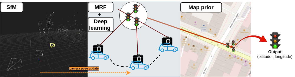
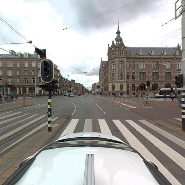
The MRF conveniently merges information extracted from images and their metadata i.e. their associated camera location (GPS) and bearing information (cf. Fig. 1). 33footnotetext: https://play.google.com/store/apps/details?id=com.glidelinesystems.dioptra33footnotetext: https://play.google.com/store/apps/details?id=com.glidelinesystems.dioptra Currently, the pipeline of Krylov et al. assumes that the metadata associated with the camera view pose is noiseless, however, it is not always the case (e.g. due to GPS receiver imprecision) and consequently, this noise affects the accuracy of the geo-location of the assets found. In this paper, we propose to improve that pipeline by (1) denoising the camera metadata using Structure from Motion (SfM) and (2) using contextual information extracted from Open Street Map (OSM)444https://www.openstreetmap.org/ to push the predictions to a more probable area where the objects should be situated based on road and building locations. Fig. 2 summarizes our contributions and our approach has been validated for traffic light geolocation (c.f. Sec.4).
2 State of the Art
2.1 Camera geolocalization
Various Simultaneous Localization and Mapping (SLAM) and SfM techniques have been proposed to infer 3D points and to estimate the motion from a set of images [13, 27, 7, 16, 10]. Bundle adjustment (BA) is integrating matched points within a sequence of images and finding a solution simultaneously optimal with respect to both camera parameters and 3D points. Agarwal et al. [2] is first to propose the bundle adjustment that is used in the structure from motion. The trajectory of camera pose estimation is based on relative measurements, error accumulation over time thus leads to drift. Lhuillier [17] proposed to use GPS geotag in the bundle adjustment optimization. A similar problem is the camera re-localization [29, 1]. A GPS tag and SfM technique are used to geo-localize a street view image by estimating its relative pose against images from a database. Bresson et al. [6] and Kendall et and al. [11] proposed to employ a CNN (Convolution Neural Network) features to estimate camera pose transformation.
2.2 Object geotagging
Qin et al. [24, 23] proposed to estimate the instance-level depth of objects in images as an alternative to pixel-wise depth estimation. They found out the latter (obtained by minimising the mean error for all pixels) sacrifices the accuracy of certain local areas in images. Bertoni et al. [5] employed a prior knowledge of the average height of humans to perform pedestrian localization. Qu et al. [25] proposed to detect and locate traffic signs from a monocular video stream. They relied on bundle adjustment with image GPS geo-tag to reconstruct a sparse point cloud as a 3D map, then align it with several landmarks from the 3D city model generated by Soheilian et al. [26].
Wegner et al. [28] proposed a probabilistic model to locate trees. They employed multiple modalities, including aerial view semantic segmentation, street view detection, map information as well as the tree distance prior. Information is fused into a conditional random field (CRF) to predict the positions of trees. However, identical features may be mismatched in case the recurring objects sit nearby. To solve this issue, Nassar et al. [20, 21] employed the soft geometry constraint on geo-location of camera pose to identify a same object that appears in two views. They concatenate camera pose information together with image features and decode them using a CNN. The same object in first view can be re-identified in the second view.
Nassar et al. [19] extend the method by constructing a graph from detected bounding boxes across the multi-views, feed the graph to a GNN [12] and let the GNN identify the same objects across different views. Hebbalaguppe. et al. [9] predicted bounding boxes around street objects, which was followed by the two-view epipolar constraint to reconstruct 3D feature points from the two observed scenes. However, the 3D feature point does not necessarily fall inside the target bounding box. Krylov et al. [15] employed the camera pose from multiple views as a soft constraint and used semantic segmentation of images alongside a monocular depth estimator to extract the information (bearing and depth) about objects of interest, and feeds the obtained information into an MRF model that predicts their locations.
3 Methods
We present camera calibration using the SfM technique in Section 3.1, which provides a higher quality information to be used as an input to the MRF presented in Section 3.2. Section 3.3 proposes a post-processing method to refine the MRF predictions.

3.1 Structure from Motion: using optical observation to denoise on GPS data
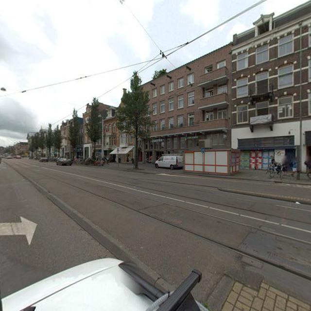
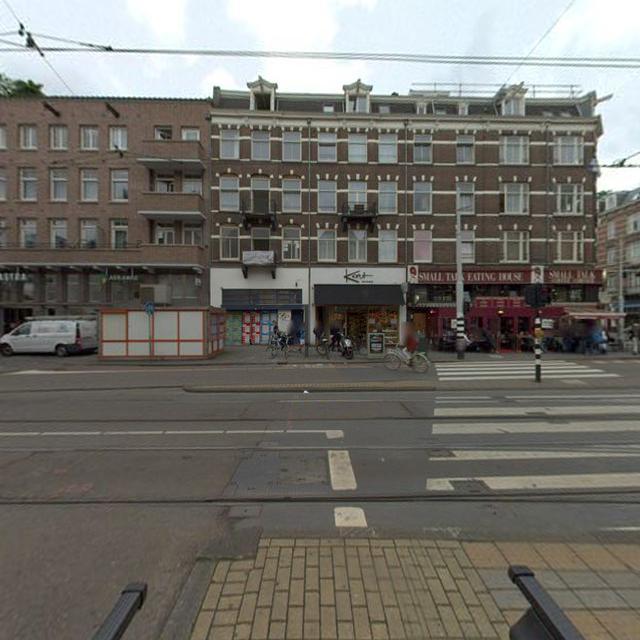
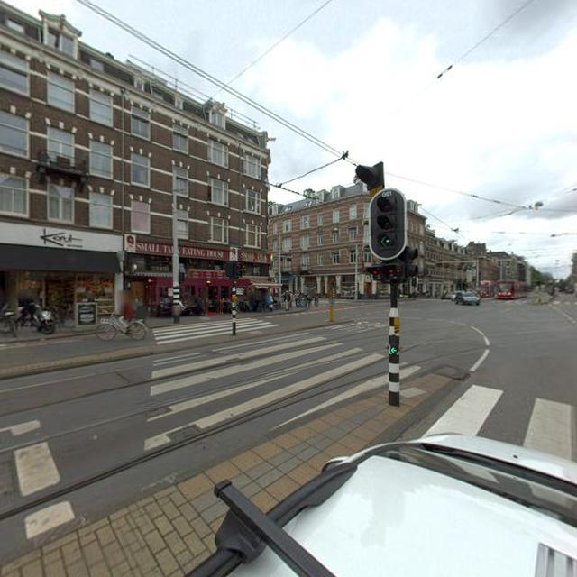
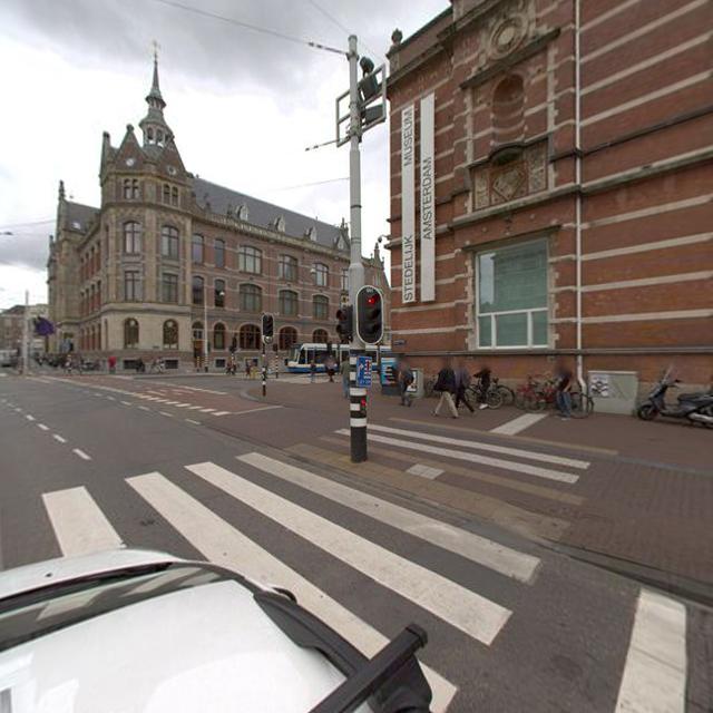
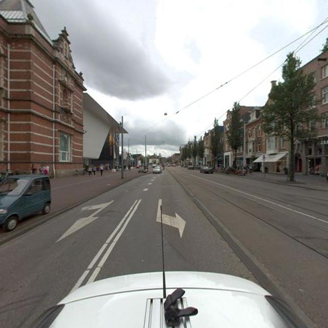
The input represents a set of panoramic street view images (360° field of view) captured with their metadata in an area of interest. Accurate camera geo-location is a key to accurately geo-locate objects in the scene. The GPS position in the metadata is inherently noisy, which lowers the accuracy for predicting object positions. To get a better estimate of the GPS coordinates associated with each camera position, we propose to tune each of the camera positions with a conventional 3D reconstruction pipeline [3], followed by bundle adjustment [2]. To ease image matching, we split the 360° panorama views into 8 overlapping rectilinear views: each view covers a 90-degree field of view and is overlapped by 45 degrees in the horizontal direction. Each view is then considered as an image captured by a pinhole camera, free of distortion (see Figure 3).
We aim to find all possible matching features extracted from our images and perform camera calibration to adjust the camera pose from image metadata.
We note the set of rectilinear views where corresponds to rectilinear views associated with panorama ( in our experiment). Suppose two views are matched by their detected features. The epipolar constraint with 5 point algorithm [3] is applied to find the essential matrix which establishes the geometry relationship between two views. can be further decomposed into translation and rotation matrix, noted as and , respectively. They can be put together as a transformation matrix
| (1) |
Each calibrated view in is associated with , these parameters can be estimated by minimizing the re-projection error from 3D feature space to 2D image plane within a bundle of images.
3.2 Object geolocation with MRF
The MRF model performs binary decisions on the nodes of a 2D graph, each node corresponding to an intersection between two rays. The rays correspond to rays (in 2D) with origins the camera GPS coordinates and with directions the bearings associated with the segmented object of interest (the pixel in the middle of the segmented object is chosen for the bearing information). The objects of interest are segmented using a deep learning pipeline that also estimates their distances (from the camera) [15]. Each camera view provides one or many rays shooting to the objects of interest. The MRF model is optimised to perform a binary decision for each node concerning its occupancy by the object of interest (i.e. 0 = no object, 1 = object present). For more information, please refer to [15]. Our contribution in this paper is in providing more accurate GPS coordinates for the camera positions (than originally available in the image metadata) thanks to SfM, hence improving the geo-location of the nodes on this MRF and ultimately improving the accuracy of GPS coordinates for the objects of interest.
3.3 Post-processing
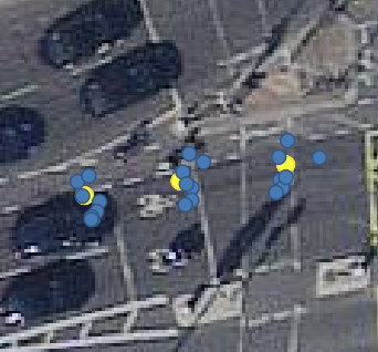
Because of the inaccuracies of the rays that define the MRF nodes, the same object may be associated with multiple nodes (Fig. 4 left) located in the same vicinity on the MRF graph. To resolve this issue Krylov et al. [15] added a hierarchical clustering step after optimising the MRF to merge close positive sites together. The final position is the average of sites in the cluster.
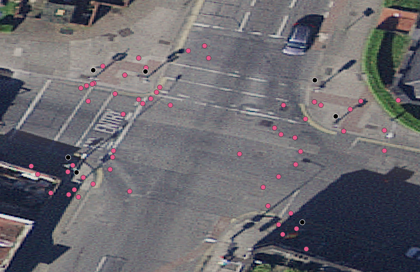
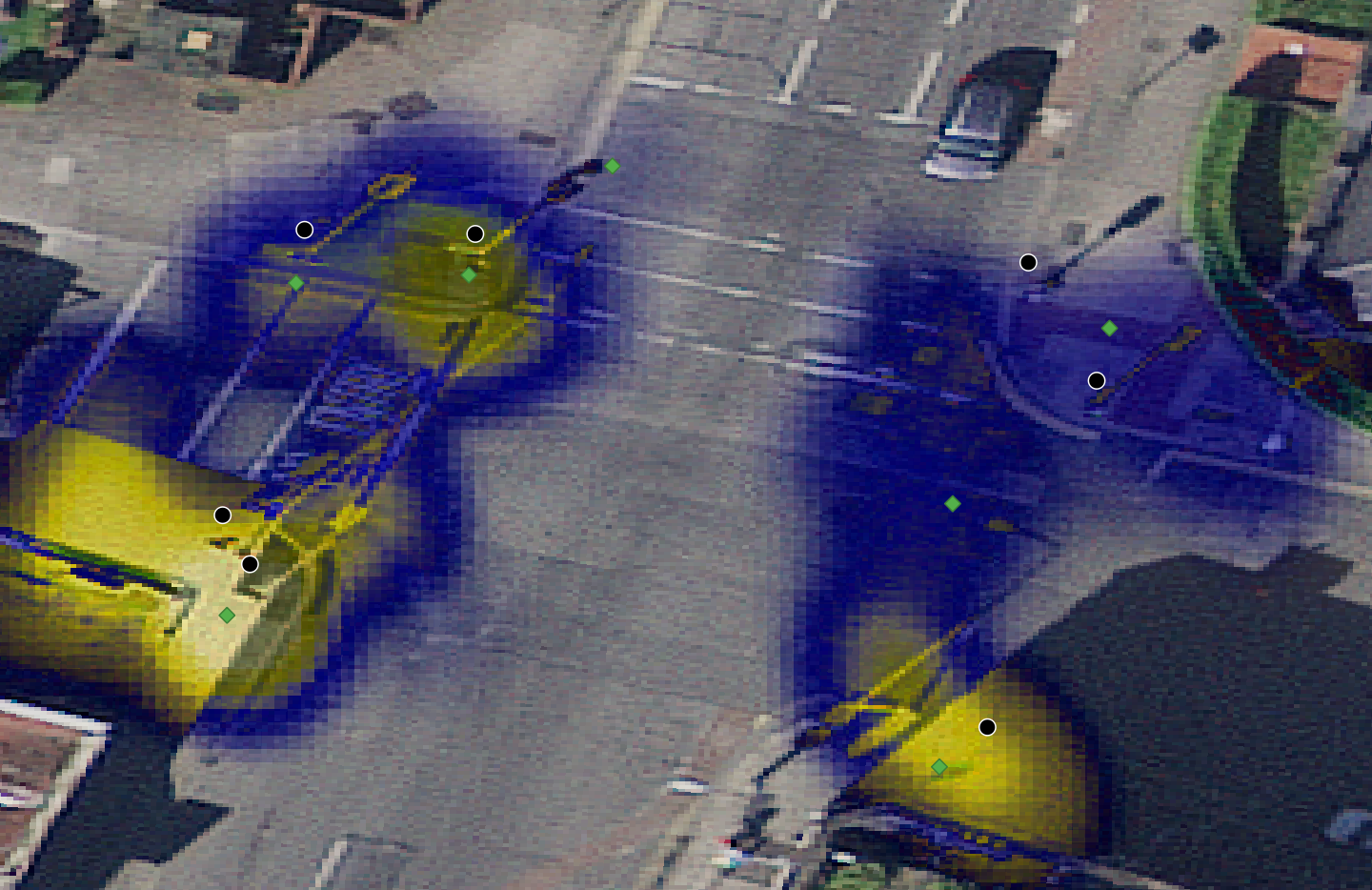
However, we have observed that some of the positive sites were situated at improbable areas, for example, in the middle of the road. Therefore, we propose here to use OSM data to act as a useful prior for an area. As our objects of interest (e.g. traffic lights) are static and are located on a side of the road, we apply the following rule: the object of interest can not be located in the middle of the road, or around the edge of a building. The OSM data has building and road classes represented by polygons and lines, respectively. A Normal kernel is fitted at each OSM node (cf. Fig. 5). Suppose a cluster containing positive sites , is the function to query the weight that corresponds to the particular site in and depends on the OSM nodes within the close proximity of the site . The position (equation 2) can be refined using a weighted average where certain sites are penalized with small weights.
| (2) |
The stands for the standard deviation in meters and the is the node centre obtained from the OSM data. The is set to 2 meters for roads and 1 meter for building edges. The resolution of the Gaussian grid is 25 centimetres.
3.4 Implementation
SURF descriptors [4] are used and in each view, 6,000 features are extracted. We employ FLANN (Fast Library for Approximate Nearest neighbours [18]) to match the SURF features between rectilinear views. RANSAC is used to remove outliers. We use the OpenSfM 555https://github.com/mapillary/OpenSfM to calibrate camera poses and Crese [2] as our solver to optimize the . As the nodes from raw OSM data are not equally distributed, we interpolate the nodes every 5 meters in QGIS 666https://www.qgis.org/en/site/ to get a dense distribution of the map prior.
4 Experimental Results
To validate our approach, we have used 896 GSV images (112 panoramas split into 8 images each) collected in Dublin city centre. The object of interest corresponds to a traffic light. We fine-tuned the input camera poses using the SfM (cf. Fig. 5). Our method corrected the bearing and position information on average by 4.36 degrees and 0.71 meters respectively. Moreover, the use of the OSM prior results in an average refinement of the prediction by 0.17 meters.
| Actual | Detected | TP | Precision | Recall | F-measure | \LongstackGeo-localization | |
| error | \LongstackGeo-localization | ||||||
| error(with OSM) | |||||||
| no correction [15] | |||||||
| 76 | 94 | 58 | 0.61 | 0.76 | 0.68 | 2.71 | 2.64 |
| correction on only | |||||||
| 76 | 89 | 57 | 0.64 | 0.75 | 0.69 | 2.79 | 2.74 |
| correction on and | |||||||
| 76 | 92 | 54 | 0.57 | 0.72 | 0.64 | 2.53 | 2.48 |
By using our SFM module we can check the impact of the following correction of the metadata: correction on only (i.e. GPS location of the camera), correction on and (i.e. correction of both GPS location and bearing of the camera). To validate our approach, we use the original metadata as our baseline for comparisons. Table 1 shows the testing results in terms of geo-localization error and precision and recall detection metrics. We consider traffic lights to be recovered accurately (true positive) if they are located within 6 meters from the reference position, otherwise it is viewed as a false positive. The geo-localization error measures the average Haversine distance between the prediction and its reference target in meters. A small distance indicates accurate position prediction.
We compare our results with related public asset geo-location approaches in Table 2. The proposed technique reaches the smallest positional error, however, the results are not directly comparable due to the different complexity of the scene and detected objects.
| Comparison with other methods | |||
|---|---|---|---|
| Method | Dataset | F-measure | Geo-localization error |
| Siamese CNN [21] | Pasadena [28] | 0.51 | 3.13 |
| Siamese CNN | Mapillary [22] | 0.72 | 4.36 |
| GNN-Geo [19] | Pasadena | 0.64 | 2.75 |
| GNN-Geo | Mapillary | 0.87 | 4.21 |
| Ours | DTL [15] | 0.64 | 2.48 |
5 Conclusion
We have shown that by denoising metadata associated with street view imagery using SfM, and by using context information such as road and building shapes extracted from OSM, assets of interest can be geolocalized with higher accuracy. Currently, our pipeline is geotagging one class of objects at a given time, and future work will investigate multiple static object class tagging with additional priors associated with their relative positioning in the scene, to improve further geolocation accuracy.
|
Acknowledgments
This research was supported by the ADAPT Centre for Digital Content Technology funded under the SFI Research Centres Programme (Grant 13/RC/2106) and co-funded under the European Regional Development Fund. We gratefully acknowledge the support of NVIDIA Corporation with the donation of the Titan Xp GPUs.
References
- [1] Pratik Agarwal, Wolfram Burgard, and Luciano Spinello. Metric localization using google street view. In 2015 IEEE/RSJ International Conference on Intelligent Robots and Systems (IROS), pages 3111–3118. IEEE, 2015.
- [2] Sameer Agarwal, Noah Snavely, Steven M Seitz, and Richard Szeliski. Bundle adjustment in the large. In European conference on computer vision, pages 29–42. Springer, 2010.
- [3] Alex M Andrew. Multiple view geometry in computer vision. Kybernetes, 2001.
- [4] Herbert Bay, Andreas Ess, Tinne Tuytelaars, and Luc Van Gool. Speeded-up robust features (surf). Computer vision and image understanding, 110(3):346–359, 2008.
- [5] Lorenzo Bertoni, Sven Kreiss, and Alexandre Alahi. Monoloco: Monocular 3d pedestrian localization and uncertainty estimation. In Proceedings of the IEEE/CVF International Conference on Computer Vision, pages 6861–6871, 2019.
- [6] Guillaume Bresson, Li Yu, Cyril Joly, and Fabien Moutarde. Urban localization with street views using a convolutional neural network for end-to-end camera pose regression. In 2019 IEEE Intelligent Vehicles Symposium (IV), pages 1199–1204. IEEE, 2019.
- [7] Mark Cummins. Highly scalable appearance-only slam-fab-map 2.0. Proc. Robotics: Sciences and Systems (RSS), 2009, 2009.
- [8] Rozenn Dahyot. Analyse d’images séquentielles de scènes routières par modèles d’apparence pour la gestion du réseau routier (Appearance based road scene video analysis for the management of the road network). PhD thesis, University of Strasbourg I, France, November 2001. (published in French).
- [9] Ramya Hebbalaguppe, Gaurav Garg, Ehtesham Hassan, Hiranmay Ghosh, and Ankit Verma. Telecom inventory management via object recognition and localisation on google street view images. In 2017 IEEE Winter Conference on Applications of Computer Vision (WACV), pages 725–733. IEEE, 2017.
- [10] Jared Heinly, Johannes L Schonberger, Enrique Dunn, and Jan-Michael Frahm. Reconstructing the world* in six days*(as captured by the yahoo 100 million image dataset). In Proceedings of the IEEE Conference on Computer Vision and Pattern Recognition, pages 3287–3295, 2015.
- [11] Alex Kendall, Matthew Grimes, and Roberto Cipolla. Posenet: A convolutional network for real-time 6-dof camera relocalization. In Proceedings of the IEEE international conference on computer vision, pages 2938–2946, 2015.
- [12] Thomas N Kipf and Max Welling. Semi-supervised classification with graph convolutional networks. arXiv preprint arXiv:1609.02907, 2016.
- [13] Bryan Klingner, David Martin, and James Roseborough. Street view motion-from-structure-from-motion. In Proceedings of the IEEE International Conference on Computer Vision, pages 953–960, 2013.
- [14] Vladimir A. Krylov and Rozenn Dahyot. Object geolocation using mrf based multi-sensor fusion. In 2018 25th IEEE International Conference on Image Processing (ICIP), pages 2745–2749, 2018.
- [15] Vladimir A. Krylov, Eamonn Kenny, and Rozenn Dahyot. Automatic discovery and geotagging of objects from street view imagery. Remote Sensing, 10(5), 2018.
- [16] Taehee Lee. Robust 3d street-view reconstruction using sky motion estimation. In 2009 IEEE 12th International Conference on Computer Vision Workshops, ICCV Workshops, pages 1840–1847. IEEE, 2009.
- [17] Maxime Lhuillier. Fusion of gps and structure-from-motion using constrained bundle adjustments. In CVPR 2011, pages 3025–3032. IEEE, 2011.
- [18] Marius Muja and David G Lowe. Fast matching of binary features. In 2012 Ninth conference on computer and robot vision, pages 404–410. IEEE, 2012.
- [19] Ahmed Samy Nassar, Stefano D’Aronco, Sébastien Lefèvre, and Jan D Wegner. Geograph: Graph-based multi-view object detection with geometric cues end-to-end. In European Conference on Computer Vision, pages 488–504. Springer, 2020.
- [20] Ahmed Samy Nassar, Nico Lang, Sébastien Lefèvre, and Jan D Wegner. Learning geometric soft constraints for multi-view instance matching across street-level panoramas. In 2019 Joint Urban Remote Sensing Event (JURSE), pages 1–4. IEEE, 2019.
- [21] Ahmed Samy Nassar, Sébastien Lefèvre, and Jan Dirk Wegner. Multi-view instance matching with learned geometric soft-constraints. ISPRS International Journal of Geo-Information, 9(11):687, 2020.
- [22] Gerhard Neuhold, Tobias Ollmann, Samuel Rota Bulo, and Peter Kontschieder. The mapillary vistas dataset for semantic understanding of street scenes. In Proceedings of the IEEE International Conference on Computer Vision, pages 4990–4999, 2017.
- [23] Zengyi Qin, Jinglu Wang, and Yan Lu. Monogrnet: A geometric reasoning network for monocular 3d object localization. In Proceedings of the AAAI Conference on Artificial Intelligence, volume 33, pages 8851–8858, 2019.
- [24] Zengyi Qin, Jinglu Wang, and Yan Lu. Triangulation learning network: from monocular to stereo 3d object detection. IEEE Conference on Computer Vision and Pattern Recognition (CVPR), 2019.
- [25] Xiaozhi Qu, Bahman Soheilian, and Nicolas Paparoditis. Vehicle localization using mono-camera and geo-referenced traffic signs. In 2015 IEEE Intelligent Vehicles Symposium (IV), pages 605–610. IEEE, 2015.
- [26] Bahman Soheilian, Olivier Tournaire, Nicolas Paparoditis, Bruno Vallet, and Jean-Pierre Papelard. Generation of an integrated 3d city model with visual landmarks for autonomous navigation in dense urban areas. In 2013 IEEE Intelligent Vehicles Symposium (IV), pages 304–309. IEEE, 2013.
- [27] Akihiko Torii, Michal Havlena, and Tomáš Pajdla. From google street view to 3d city models. In 2009 IEEE 12th International Conference on Computer Vision Workshops, ICCV Workshops, pages 2188–2195. IEEE, 2009.
- [28] Jan D Wegner, Steven Branson, David Hall, Konrad Schindler, and Pietro Perona. Cataloging public objects using aerial and street-level images-urban trees. In Proceedings of the IEEE Conference on Computer Vision and Pattern Recognition, pages 6014–6023, 2016.
- [29] Li Yu, Cyril Joly, Guillaume Bresson, and Fabien Moutarde. Monocular urban localization using street view. In 2016 14th International Conference on Control, Automation, Robotics and Vision (ICARCV), pages 1–6. IEEE, 2016.