The first measurement of the deflection of the vertical in longitude
Abstract
During the summer of 1837 Christian Ludwig Gerling, a former student of Carl Friedrich Gauß’s, organized the world wide first determination of the deflection of the vertical in longitude. From a mobile observatory at the Frauenberg near Marburg (Hesse) he measured the astronomical longitude difference between C.F. Gauß’s observatory at Göttingen and F.G.B. Nicolai’s observatory at Mannheim within an error of 04. To achieve this precision he first used a series of light signals for synchronizing the observatory clocks and, second, he very carefully corrected for the varying reaction time of the observers. By comparing these astronomical results with the geodetic–determined longitude differences he had recently measured for the triangulation of Kurhessen, he was able to extract a combined value of the deflection of the vertical in longitude of Göttingen and Mannheim. His results closely agree with modern vertical deflection data.
1 Introduction
The discussion about the figure of the earth and its determination was an open question for almost two thousand years, the sciences involved were geodesy, geography and astronomy. Without precise instruments the everyday experience suggested a flat, plane world, although ideas of a spherically shaped earth were known and accepted even in the ancient world. Assuming that the easily observable daily motion of the stars is due to the rotation of the earth, the rotational axis can be used to define a celestial sphere; a coordinate system, where the stars’ position is given by two angles. Projecting this celestial sphere on the globe of the earth, one can now determine the geographical latitude by observing the height of stars. The geographical longitude can be deduced from the meridian transit time of stars. These coordinates are numbers on a perfectly shaped sphere. By comparing these measurements with those obtained from field measurements, from a triangulation of the earth’s surface, a more sophisticated model of the figure of the earth appears: the mean shape can be described as an ellipsoid of rotation where, due to centrifugal forces, the polar diameter is 43 km shorter than the equatorial diameter. The real earth figure, the so called geoid, deviates from the ellipsoid of rotation in the range of m in height. The geoid corresponds to the equipotential surface of the mean global sea surface, which theoretically will continue under the continents. The difference between the measured direction of gravity and the normal of the ellipsoid of rotation is called the deflection of the vertical. Nowadays it can easily be determined by the difference of measured stars in zenith direction from the calculated stars using the ellipsoid of rotation model. The pole flattening of the earth is in the range of some of the mean diameter, the deviation of the real shape of the earth from the ellipsoid of rotation is smaller by another three orders of magnitude. Thus the ability to detect and to measure these deviations reflects the sensitivity of the instruments and methods available at any particular period.
This paper summarizes the historical development of methods to determine the figure of the earth and then concentrates on the first measurements of a deflection of the vertical in the first half of the 19th century, especially the deflection of the vertical in longitude, which is much harder to observe than that in latitude. It is a masterpiece of an astronomic–geodetic measurement on the very edge of the possibilities of that time.
2 The Earth: an ellipsoid of rotation
Determining of the figure of the earth has been a challenge for centuries. In the ancient world Eratosthenes (about 240 B.C.) assumed a spherical shape. He deduced the earth’s radius from a measurement of the zenith angle of the sun at different positions on the earth and the length of path between those positions, i.e. the arc length of the meridian between the two locations. This is the first known arc measurement: one compares the length of an arc on the earth at a fixed longitude with the length of the corresponding arc on the sky. Eratosthenes himself did not actually measure the arc on the earth, but most probably used the distance between the two positions from the Egypt cadaster maps determined by step counters Torge (2001). He achieved a precision of about 10%. In the Early Middle Ages Al-Ma’mun, caliph of Baghdad, commissioned an arc measurement of 2 degrees and determined the radius of the earth with an error between 1 and 2%.
In the 17th century, when the concept of gravity was introduced, scientists started to ask how measurements of the earth’s mean specific weight and its exact shape could give clues to its internal structure. Using a pendulum with a period of oscillation proportional to the square root of the ratio of its length and the acceleration due to gravity, first systematic deviations of the earth’s gravity at different geographic latitudes were found. Isaac Newton proposed a rotational ellipsoid as an equilibrium figure for a homogeneous fluid rotating earth with a different curvature at the equator and the poles. To test this assumption the French Academy of Sciences initiated two arc measurement campaigns: First, in Peru, at low latitudes, Pierre Bouguer, Charles de la Condamine and Louis Godin conducted measurements from 1735 to 1744, and second, in 1736/37 Pierre-Louis Moreau de Maupertuis and Alexis-Claude Clairaut were sent to Lapland for measurements at high latitudes Torge (2001). The result of the expeditions’ findings was that the diameter of the earth at the poles is shorter by about 1/300 compared to the diameter at the equator — the ellipsoid of rotation as the figure of the earth was born.
The scientists knew that mountains and depths could not be described by a simple body of rotation. However the value of the earth’s rotation is constant within a precision which could not be achieved in the 18th century, therefor the measurable mean shape of the earth should be fairly close to a geometrically defined body of rotation. Commissioned by the French Academy Pierre Méchain and Jean-Baptiste Joseph Delambre organized an arc measurement in France between 1792 and 1798 Alder (2003). Equipped with new and more precise instruments their goal was to measure the precise length of a meridian arc of about 10 degree latitude difference and, by comparing this with the zenith angle difference of the arc’s ends, to determine a value for the size of the earth with a precision not yet attained. After knowing the precise size of the earth with this value, a new measure of length was to be defined: the meter.
Overall, the expedition was successful in delivering more precise measures of the figure of earth. However, it revealed an astonishing result: the curvature of the meridian arc passing through Paris was larger than the supposed mean value by a factor of approximately two, leading to a pole flattening of 1/150 Laplace (1799). Unfortunately the goal of a generally accepted definition of the meter could not be achieved. In his final report of the expedition Delambre combined their results with those of the former Peruvian arc measurement and finally used 1/334 for determining the length of the meter Torge (2001). Méchain, Delambre and other scientists started to accept that any meridian arc of the earth features its own curvature and, considering the precision of measure achievable at the end of 18th century, that the earth could no longer be described as a symmetric body of rotation. However, in the following years the main goal was to precisely describe the mean ellipsoid of rotation of the earth. Henrik Johan Walbeck determined a flattening of 1/302.78 from five arc measurements Gauß (1828). This numerical value was used by Carl Friedrich Gauß and Christian Ludwig Gerling for their triangulations. From the results of ten different arc measurements and a further correction of the French arc measurement Friedrich Wilhelm Bessel calculated an oblateness of 1/299.1528 [Bessel 1837;Bessel 1841]. As of 1979 the ellipsoid defined by GRS80 (geodetic reference system 1980) with a pole flattening of 1/298.257222101 is the recommended value of the best description of a global reference ellipsoid.
3 Christian Ludwig Gerling
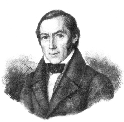
Christian Ludwig Gerling (Fig. 1) was born in Hamburg, Germany, in 1788. He was educated together with his longtime friend Johann Franz Encke, who later became director of the Berlin Observatory. After finishing school, Gerling attended the small University of Helmstedt, but in 1810 he continued his academic education in the fields of mathematics, astronomy, physics and chemistry at the University of Göttingen. He started working at the observatory of Göttingen under Carl Friedrich Gauß and Karl Ludwig Harding, and, after some visits in 1811 to the observatories of Gotha (Seeberg), Halle and Leipzig, he completed his PhD in 1812.
After he received his PhD Gerling entered a position at a high school in Cassel, Hesse. At that time he used a small observatory in Cassel for astronomical observations and occupied himself with calculating the ephemerides of the asteroid Vesta. He continued to seek a university position and finally in 1817 was appointed full professor of mathematics, physics and astronomy and director of the ”Mathematisch–Physikalisches Institut” at the Philipps–Universität of Marburg. In spite of several offers elsewhere, he remained at the university in Marburg until his death in 1864 Madelung (1996).
Gerling’s scientific work was affected by two mayor topics. In his early period in Marburg from 1817 to 1838 he was rather occupied with organizing the main triangulation of Kurhessen, the data analysis and publication of the results.
In 1838 the institute moved to a new home in Marburg at the ”Renthof”. After the building was reconstructed in 1841, he could finally put into operation his new but small observatory, built on top of a tower of Marburg’s old city wall Schrimpf (2010). Gerling pursued the scientific topics of astronomy of that time, making meridional observations and differential extra-meridional measurements of stars, planets and asteroids, observations of lunar occultations, etc., mainly to improve the precision of star catalogs and orbit parameters of solar system bodies.
Carl Friedrich Gauß and Christian Ludwig Gerling’s relationship began as a teacher and student, but during the following years they became each others’ counselor and finally close friends. The correspondence between Gerling and Gauß not only contains details of scientific discussions but also reflects their close relationship [Schäfer 1927;Gerardy 1964]. Gauß taught Gerling the careful and correct use of scientific instruments and also the mathematical methods necessary for reducing geodetic and astronomic measurements. Gerling published a widely used textbook about planar and spherical trigonometry (the last edition published posthumously in 1865) and he became well known as a teacher in the practical use of many of the methods Gauß developed theoretically, for example the use of least squares in geodesy Gerling 1843a . Gerling died in 1864 at the age of 76. Johann Jacob Baeyer wrote in his obituary: ”With him, the ’Mitteleuropäische Gradmessung’ [Central European Arc Measurement] has lost a geodetics scientist of the highest order and with vast experience. He was the last living associate of Gauß’ involved with the Hannover arc measurement and so completely conversant with the method of his great mentor, who himself left no documentation of it, that he might have shed some light upon questions that now perhaps may forever remain in the dark” Baeyer (1864).
4 The triangulation of Kurhessen
In the spring of 1821, William II, elector of Hesse, sought Gerling’s expertise about the triangulation and topographical map of Kurhessen - the electorate of Hesse. After a first field exploration in fall 1821 and spring 1822 Gerling received the order of the triangulation of Kurhessen [Gerling 1839;Reinhertz 1901], which was carried out in two periods from 1822 to 1824 and 1835 to 1837 (Fig. 2). In the northern region he included the triangle Brocken–Hohenhagen–Inselsberg, which Gauß had measured during his Hannover arc measurement. In the south Gerling connected his triangulation network with some of the survey marks close to Frankfurt, Hesse, of a former Bavarian triangulation and a former triangulation of the Grand Duchy of Hesse Torge (2009).
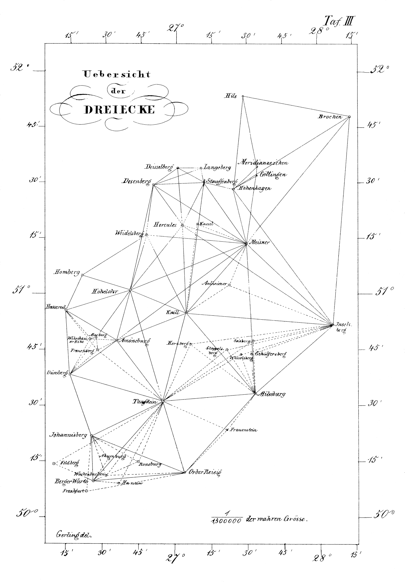
For the triangulation Gerling used a twelve inch repeater theodolite from Reichenberg–Ertel (Munich) and a ten inch universal theodolite from Breithaupt (Cassel, Hesse). For local centering he used a copy of a Toise du Pérou, which he had bought from Fortin, Paris, in 1831. Both the Breithaupt theodolite and the Toise are exhibited today in the scientific instrument collection of the Physics Department of the Philipps–Universität Marburg. Gerling’s triangulation comprised twenty four main geodetic reference points (first class) and seventeen marks of lower precision (second class). The base he used was the distance of Gauß’s observatory to its meridian mark. Gauß had deduced this distance from the base that Heinrich Christian Schumacher had determined during the Holstein triangulation Torge (2009). For reducing the data Gerling used the reference ellipsoid of Walbeck and the positional data of Göttingen, which Gauß had determined before. He manually adjusted the network of the twenty four main geodetic reference points (first class) in one procedure, a calculation of enormous effort which Gauß gave him credit for (letter no. 290, Schäfer (1927)). The mean error of all direction in the triangulation network was , a recalculation for the ”Mitteleuropäische Gradmessung” (Central Eropean Arc Measurement) by Börsch gave an error of Baeyer (1866).
Gerling’s reduction is the first calculation of a triangulation network of Hesse using an ellipsoid of rotation as reference. One hundred and seventy five years after Gerling’s pioneering work the ”Hessisches Landesamt für Bodenmanagement and Geoinformation (HLBG)” (Hessian State Authority of Real Estate Management and Geoinformation) organized a regional survey of the preserved survey marks from Gerling’s triangulation Heckmann (2012). Many of Gerling’s marks were made of sandstone of considerable size and weight, therefore very steady. The result of the recent survey is: fourteen of Gerling’s marks of first–class points and six marks of second–class points are still at their original positions and are included in official evidence of geodetic reference points of State of Hesse. Two further first–class marks and one second–class mark could be identified in the field and one other first–class point could be reconstructed exactly. A comparison of the marks’ positions in Gerling’s triangulation with the high precision positions of the reference system used currently has revealed a difference of less then 20 cm for most of the marks and only in the rare case, at the edges of the network, more than 30 cm Heckmann (2012).
5 First evidence of the deflection of the vertical
The arc measurements of the 18th and the beginning of the 19th century gradually revealed local deviations of an ellipsoid of rotation as the figure of the earth. To precisely determine the moon’s position, one needed to know the exact local curvature. In 1810 Johann Georg von Soldner therefore suggested building an observatory in Africa close to the equator for moon observations and conducting a precise arc measurement Torge (2009). Pierre–Simon Laplace and von Soldner introduced the idea of a flattening which must be described as a function of latitude and longitude Torge (2009). However, the known facts about the curvature of the earth at the beginning of the 19th century were simply additional results from measurements of the symmetric rotational figure of the earth.
In the 18th century the seconds pendulum became popular in the search for a new measure of length. To a close approximation a pendulum of 1 m length has a half period of oscillation of 1 second. The physical reason is that the oscillation frequency depends on the gravitational acceleration and the mean value at the surface of the earth is responsible for this finding. However, in the early 19th century, scientists began to realize that a deviation from a perfectly symmetric form of the earth might manifest itself not only in differing curvature, but also differing gravitational acceleration. In 1818 Henry Kater explained for the first time the use of a modified seconds pendulum for measuring the gravitational acceleration Kater (1818). However, this pendulum was not easy to use in the fields. The first movable instruments were developed in the 1860s, motivating more gravitational measurements, but the breakthrough came in the 20th century, when the free-fall gravimeters became available.
Most probably in 1827 C.F. Gauß undertook the first measurement of the deflection of the vertical, which he explained in his report on determining the latitude difference between the observatories in Göttingen and Altona Gauß (1828). Using a Ramsden zenith sector he measured the zenith distance of particular stars in both observatories. He then compared the astronomically determined latitudes with those reduced from the triangulation of the kingdom of Hannover from 1821–1824. The astronomical latitude difference was less by 552. Also, with the pole height of the mountain Brocken (the highest peak of the Harz mountain range), which had been astronomically determined by Franz Xaver von Zach, he found a 10 – 11′′ larger astronomical latitude difference between Göttingen and the Brocken, and finally a 16′′ larger astronomical latitude difference between Altona and the Brocken (for further details see Wittmann (2010).) Gauß stated in his article, that this difference did not seem very unusual; on the contrary, he expected such differences to be found everywhere on the earth if the methods used to determine them would be one or two orders of magnitude more precise. However, he continued ”that not until some time in the future centuries will the mathematical knowledge of the figure of the earth be significantly advanced” Gauß (1828).
Unfortunately Gauß was right with this statement. It is striking that until the beginning of the 19th century all reported astronomic–geodetic measurements focused on the latitudes; all measurements of comparison were taken along the same meridian, in the north–south direction. However, to correctly describe the deflection of the vertical, one must also consider the deflection in longitude, the east–west direction. In the second half of the 19th century Friedrich Robert Helmert established the following definition of the deflection of the vertical Torge (2001):
| (1) |
with the astronomical latitude , the geodetic latitude , the astronomical longitude and the geodetic longitude .
For latitude measurements one had to determine zenith angles of stars, but for measuring longitude differences the transit time of stars at the local meridian had to be accurately observed. The precision of the longitude measurements depends on the precision of the transit time measured. To keep the error smaller than 01, the time had to be determined accurately to / sec = seconds. In addition, not only the time measurement itself, but also the time differences between transits at different locations on the earth had to be measured with the same precision to determine a deflection of the vertical in the range of 01. Not an easy task in the 19th century.
In 1824 Friedrich Bernhard Nicolai organized longitude measurements in the area of Mannheim Nicolai (1825), which can be regarded as precursor experiments to Gerling’s later measurements. Participating in a French longitude campaign, Nicolai, together with the French colonel Henry, Johann Gottlieb Friedrich von Bohnenberger and Friedrich Magnus Schwerd determined the longitude differences between Straßbourg, Tübingen, Speyer and Mannheim by synchronizing the observatory clocks via explosive signals — a technique that had been suggested before by von Zach and tested by Karl von Müffling Berghaus (1826) — and by observing the transits of the same stars in all of the four observatories. The local sidereal time was calculated from transits of Bessel’s fundamental stars. The differences between the transit times directly gave the longitude differences. Comparing these with results from triangulations (geodetic data), Nicolai could find an ”excellent agreement” Nicolai (1825) of geodetic and astronomic data for the difference Mannheim–Straßbourg (geodetic 2′ 5405), a minor deviation of 035 for the difference between Mannheim and Tübingen (geodetic 2′ 2191) and a deviation of 016 for the difference between Mannheim and Speier (geodetic 490). Obviously Nicolai used the astronomical measurements to confirm the geodetic data; he did not expect to observe a difference.
6 Gerling’s measurements at the Frauenberg in the summer of 1837
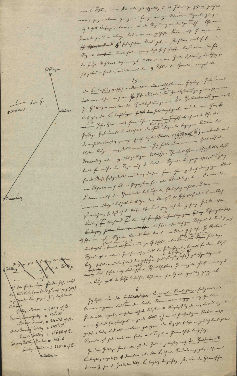
To complete the triangulation of Kurhessen Gerling decided in 1837 to organize an astronomical longitude measurement across the entire network he had just established Gerling (1838). As Nicolai before, Gerling was searching for a control measurement. The larger and steadier instruments in the observatories were expected to deliver more precise results. Therefore Gerling chose Göttingen in the north east of his network and Mannheim in the south, approximately on the same longitude as the Feldberg (Taunus) at the western edge. In Göttingen C.F. Gauß and his assistant Carl Benjamin Goldschmidt could be convinced to participate, and in Mannheim Gerling’s colleague and friend Nicolai supported the campaign. In 1837 Gerling did not yet have an observatory in Marburg, therefore he chose the Frauenberg, a small hill six km south–east of Marburg, as his temporary observation site. A couple of years before, Gerling had used a flag signal at the ruin on Frauenberg as survey mark of second class for the Kurhessian triangulation. In 1837 Gerling set a great stone post on top of the hill as a steady mount for his theodolite. Furthermore, he transported his new high precision Box chronometer from Kessels (Hamburg), which he just had bought for his planed observatory, to the Frauenberg and raised a tent over the site. The task was to synchronize the three observatory clocks and then to perform a series of transit observations of the same stars in each of the participating observatories. These measurements were scheduled for late summer in 1837, beginning on 24th August and ending on 9th September.
In the 19th century observatories where very familiar with transit measurements, or meridional measurements; this was the easy part of Gerling’s campaign. Gauß and Nicolai conveyed the sidereal times of their observatories to Gerling. At the Frauenberg the stone post had unfortunately been set in soft ground and Gerling detected that it was still moving during the campaign. He therefore used corresponding solar altitudes to determine the local solar time, and from that he calculated the sidereal time at Frauenberg.
The real challenge of the campaign was synchronizing the clocks to a precision that would allow Gerling to detect a deviation between the geodetic and the astronomical longitude differences. The only way to synchronize distant clocks in the first half of the 19th century was with light signals. Because the Hohe Meißner in the northern part of Hesse could be seen from Göttingen and Marburg, and the Feldberg was visible in Marburg and in Mannheim, both mountains were used as signal stations. In the late afternoon a co–worker at each of the two stations had to send heliotrope signals every 8 minutes into both directions with an offset of 4 minutes in between the two stations. After nightfall a series of explosive signals were sent. This was repeated on each day during the campaign in the late summer of 1837, whenever the weather conditions would allow measurements. During the day, corresponding solar altitudes were recorded and at night the transits of stars observed; thus the shift of the clocks could be monitored. Altogether 216 signals were sent from the Meißner and 136 signals from the Feldberg station, of which 116 corresponding signals from both stations finally formed the data base for synchronizing the clocks.
Time measurements at that time were typically performed in the following way: The observer was expecting a certain event, for example the transit of a star passing a mark in the eyepiece of the telescope. When he recognized the event, he notified a coworker who recorded the time from the clock. There were two drawbacks to this method: First, because such a measurement could not be double–checked, there was no way to assure accuracy. Therefore measurements were repeated often in the hope that no or only very few systematical errors would occur. Second, one systematic error could not be excluded in this type of measurements: the reaction time of the observer, the so–called ”personal equation”. Gerling visited his colleagues in Göttingen and Mannheim and determined the personal equation of each observer by comparing meridional observations of stars and by noting the time of passages of a pendulum. He could thus estimate not only the statistical error, but also the offset due to the reaction time. The offset turned out to be surprisingly large, which led Gerling to mention it in a letter to Gauß (letter no. 294 Schäfer (1927)) and to question the former longitude determination of the island ”Helgoland”, Greenwich and Paris.
After reducing the data Gerling published the following astronomically determined longitude differences in units of time (24h = 360∘) Gerling (1838)
| Göttingen–Frauenberg: | 4m 3619 00152 |
| Frauenberg–Mannheim: | 1m 1967 00208 |
| Göttingen–Mannheim: | 5m 5586 00258. |
The precision of the results is remarkable. Gerling achieved an error not greater than 0.025 seconds on the time scale, which results in 04 in angular units.
With this result Gerling ended his article, which he submitted to the Astronomische Nachrichten. The significance of these measurements did not become clear until the following contact with Gauß. In a letter dated 8 October 1838 (letter no. 294, Schäfer (1927)), he mentioned noticeable deviations of different longitude measurements that he used to confirm his results. Gauß pointed out that some of the measurements Gerling was citing were geodetic and others astronomic longitude determinations and that he, Gauß, did not expect them to show the same results. He mentioned his former latitude measurements in northern Germany (letter no. 296, Schäfer (1927)). It was this remark of Gauß’s, that opened Gerling’s eyes: he had performed the first measurement of the deflection of the vertical in longitude, and the deviation of the astronomic and geodetic measurements was a new and very valuable result. His measurements initiated new quality of measurements. He replied to Gauß (letter no. 297, Schäfer (1927)): ”If I must accuse myself here of gross error and lack of thoroughness in applying your § [symbol refers to a section of Gauß’ article from 1828], then perhaps I can find comfort in that there are probably ”not five persons existing in Europe” who have taken heed of the § in this sense. …I therefore feel compelled in this context to implement my own study in another and more rational manner than I had originally intended with insufficiently defined terms; and this is a great new merit which belongs to you in this study.”
In the final publication of the triangulation of Kurhessen Gerling presented the longitude measurements of summer 1837 (Gerling (1839), page 204 ff.) in very different words. This time he indicated the difference between astronomically and geodetically determined longitudes and listed the deviations he found (Table 1). The deviations are significant and are within the range of the deviations Gauß determined for latitudes in northern Germany.
| astronomic longitude | geodetic longitude | deviation | |
| difference | difference | ||
| Göttingen–Frauenberg | 1∘ 09′ 0285 | 1∘ 09′ 1949 | |
| Frauenberg–Mannheim | 19′ 5505 | 19′ 4285 | |
| Göttingen–Mannheim | 1∘ 28′ 5790 | 1∘ 29′ 0232 |
7 Comparison with later measurements
In 1841 Gerling could put his new observatory at the castle hill of Marburg into operation. Via a local triangulation he determined the geodetic position of the post on which the observatory’s instrument was mounted Gerling 1843b : longitude 26∘ 26′ 21 east of Ferro (Ferro was used as reference meridian until 1884; the longitude of Ferro is 17∘ 40′ 00′′ west of Greenwich) and latitude 50∘ 48′ 469 N.
The astronomical longitude of Gerling’s observatory was determined by Ernst Wilhelm Klinkerfues, a student of his who later became director of the observatory in Göttingen and Gauß’s successor. Klinkerfues reduced observations of occultations of stars by the moon, which had been recorded and published frequently and which were a valuable tool for calculating astronomical longitudes. The result for the astronomical longitude of Gerling’s observatory was 18m 2838 west of Berlin Gerling (1855). In this note Klinkerfues was quoted: ”However, because there are only very few locations where the longitude is determined as well or even more accurately than that in Marburg, it seemed ineffective to me, at least for the purpose I had restricted myself to, to consider all observations. Even the corresponding observations made at major astronomical observatories I did not include if, as in two cases, the corrections to the tables from the Greenwich meridian observations were known”. Again, the difficulties of high quality longitude determination is accentuated.
The astronomical latitude of Gerling’s observatory was precisely determined in 1862 by Richard Mauritius, one of his last doctoral students. Mauritius used Bessel’s method of measuring stars in the prime vertical, which results in high precision pole height determination, and found the astronomical latitude to 50∘ 48′ 4409. Using Klinkerfues’ results and the known geodetic position of the observatory in Berlin (30∘ 03′ 30′′ east of Ferro), he calculated a deviation of the longitude difference to Berlin of and a deflection of the vertical in the latitude of Mauritius (1862).
The deviations of longitude and latitude differences determined by Gerling and his students must not be mistaken for deflection of the vertical data according to the definition in equation (1). All data presented here so far are differences of two distant stations; these are not local deviations. To collect accurate deflection data of a certain location, the entire country, or even better the entire planet, had to surveyed with a dense grid of measuring points. For each point the geodetic and astronomic position had to be measured and then a solution for all points had to be calculated. This was an important aspect of the Central European Arc Measurement organized by Johann Jacob Baeyer starting in 1862 Baeyer (1861). Unlike Gerling the scientists now could use telegraphic signals for synchronizing their clocks, an enormous advancement, but also an indication that Gerling’s measurements were unique. However, the method of observation did not change; they still had to deal with the reaction time of the observers. Friedrich Wilhelm Argelander, one of the participants and advisers of the campaign very clearly specified that ”all pole heights and longitudes across the entire area of the arc measurement are to be determined by the same observers, approximately four in number, and with completely identical instruments”, which unfortunately ”could not be conducted with absolute discipline” Hilfiker (1885). Albrecht, Bruns and Hilfiker reduced the data of the Central European Arc Measurement and published the astronomical longitudes of many of the European observatories Hilfiker (1885). However, the net was too sparse, and the number of points which should have been measured was too high for those methods. It was not until the 20th century that scientists, with modern gravimeters and zenith cameras, succeed in completing a dense network of gravimetric and astronomic measurements and calculating maps of the vertical deflection with sufficient precision. Gauß’s prediction published in 1828 was fulfilled in the 20th century.
In Table 2 Gerling’s results are compiled together with results from the Central European Arc Measurement and modern data. For comparison the astronomical data from Gerling and corresponding modern data have been marked. The table shows the progress in methods of data acquisition. The deviations of the positional data are greater than the precision of the data, which suggests hidden systematic errors.
| Göttingen (GÖ) | Frauenberg (FR) | Marburg (MR) | Mannheim (MN) | longitude difference | ||
|---|---|---|---|---|---|---|
| observatory | measuring post | observatory | observatory | GÖ–MN | GÖ–FR | |
| geodetic latitude | 51∘ 31′ 47850 | 50∘ 45′ 27751 | 50∘ 48′ 46884 | 49∘ 29′ 14681 | ||
| Walbeck | ||||||
| astronomic latitude | 50∘ 48′ 4409 | |||||
| 1862 | Mauritius (1862) | |||||
| geodetic latitude | 51∘ 31′ 42943 | 50∘ 45′ 23494 | 50∘ 48′ 42583 | 49∘ 29′ 11385 | ||
| GRS80 | ||||||
| deflection of the | ||||||
| vertical , BKG 2012 | ||||||
| astronomic latitude | 51∘ 31′ 47756 | 50∘ 45′ 23326 | 50∘ 48′ 43348 | 49∘ 29′ 11372 | ||
| today | ||||||
| geodetic longitude | 27∘ 36′ 28200 | 26∘ 27′ 08712 | 26∘ 26′ 02100 | 26∘ 07′ 27712 | 1∘ 29′ 0232 | 1∘ 09′ 1949 |
| Walbeck | ||||||
| astronomic longitude | 27∘ 36′ 2640 | 26∘ 27′ 2355 | 26∘ 26′ 243 | 26∘ 07′ 285 | 1∘ 28′ 5790 | 1∘ 09′ 0285 |
| 1839/1862 | (ref. Mannheim) | (ref. Mannheim) | (1862, ref. Berlin) | (Nicolai/Wurm) | ||
| astronomic longitude | 27∘ 36′ 35944 | 26∘ 07′ 38689 | 1∘ 28′ 58255 | |||
| 1885 | ||||||
| geodetic longitude | 27∘ 36′ 34022 | 26∘ 27′ 15677 | 26∘ 26′ 09080 | 26∘ 07′ 34912 | 1∘ 28′ 59110 | |
| (Ferro) GRS80 | ||||||
| deflection of the vertical | ||||||
| , BKG 2012 | ||||||
| astronomic longitude | 27∘ 36′ 33247 | 26∘ 27′ 20328 | 26∘ 26′ 15646 | 26∘ 07′ 36096 | 1∘ 28′ 57151 | 1∘ 09′ 12919 |
| (Ferro) today | ||||||
8 Conclusion
Gerling determined the astronomic longitude difference between Göttingen and Mannheim with a small deviation of 075 compared to modern data, which is remarkable considering the methods he used. In contrast, the longitude difference between Göttingen and Gerling’s station at Frauenberg shows a noticeable deviation of 1007. Gerling calculated the difference between Göttingen and Mannheim as the sum of the differences Göttingen–Frauenberg and Frauenberg–Mannheim. Therefore the larger deviations to Frauenberg, which cancel out in the sum, most probably reveal a systematic error in the local sidereal time or the mean solar time at Frauenberg of 067. In his article in the Astronomische Nachrichten Gerling mentioned the instability of the post he placed at the Frauenberg for his theodolite. Instead of meridional observations of stars he used corresponding solar altitudes to determine the mean solar time. He measured the height of the sun with a prism sextant and an artificial horizon, and calculated the mean solar time to control the shift of his clock. He was able to detect a jump in the shift of 0.2 sec on a cold and windy day. However, it seems reasonable that using a small instrument to determine the local time will not result in the same precision achievable with a large instrument on a steady post in an observatory. The sidereal times of Göttingen and Mannheim were very accurate and served as a perfect base for Gerling’s results.
Gerling’s measurements of the astronomical longitude difference between Göttingen and Mannheim were of unprecedented precision. Synchronizing the clocks proved to be a worthwhile effort. Contrary to Gauß’s opinion, Gerling could demonstrate that even with the methods available in the first half of the 19th century the deflection of the vertical on both latitude and longitude could be determined. In this regard Gerling deserves to be honored alongside C.F. Gauß in the history of progress to precisely determine the figure of the earth!
Acknowledgements.
Acknowledgements. I appreciate the cooperation with Bernhard Heckmann, Hessisches Landesamt für Bodenmanagement und Geoinformationen, Wiesbaden. In discussions he gave valuable hints and corrections and he obtained the modern positional and deflection of the vertical data. Also, I’d like to thank the Bundesamt für Kartographie und Geodäsie (BKG), Außenstelle Leipzig for calculation and provision of recent deflection of the vertical data. Thanks to Judith Whittaker–Stemmler for translating the quotations of the original German articles.References
- Alder (2003) Alder, K. 2003. The Measure of All Things. Free Press, New York
- Baeyer (1861) Baeyer, J.J. 1861. Über die Größe und Figur der Erde. Verlag von Georg Reimer, Berlin
- Baeyer (1864) Baeyer, J.J. 1864. General-Bericht über die mitteleuropäische Gradmessung pro 1863. Verlag von Georg Reimer, Berlin
- Baeyer (1866) Baeyer, J.J. 1866. General-Bericht über die mitteleuropäische Gradmessung für das Jahr 1865. Verlag von Georg Reimer, Berlin
- Berghaus (1826) Berghaus, H. 1826. Über die Längengradmessung zwischen Dünkirchen und dem Seeberg bei Gotha. Hertha, Zeitschrift für Erd-, Völker- und Staatenkunde 7: 5–25
- Bessel (1837) Bessel, F. 1837. Bestimmung der Axen des elliptischen Rotationssphäroids, welches den vorhandenen Messungen von Meridianbögen der Erde am meisten entspricht. Astronomische Nachrichten 14: 333–346
- Bessel (1841) Bessel, F. 1841. Über einen Fehler in der Berechnung der französischen Gradmessung und seinen Einfluss auf die Bestimmung der Figur der Erde. Astronomische Nachrichten 19: 97–116
- Gauß (1828) Gauß, C.F. 1828. Bestimmung des Breitenunterschiedes zwischen den Sternwarten von Göttingen und Altona. Vandenhoeck und Ruprecht, Göttingen. Reprint in: C.F. Gauß Werke, vol 9, B.G. Teubner, Leipzig 1903
- Gerardy (1964) Gerardy, T. 1964. Christian Ludwig Gerling an Carl Friedrich Gauß. Sechzig bisher unveröffentlichte Briefe. Vandenhoeck und Ruprecht, Göttingen
- Gerling (1838) Gerling, Chr.L. 1838. Die Längenunterschiede zwischen Göttingen (Altona), Marburg und Mannheim bestimmt durch Lichtsignale. Astronomische Nachrichten 15: 249–278
- Gerling (1839) Gerling, Chr.L. 1839. Beiträge zur Geographie Kurhessens und der umliegenden Gemeinden. Johann Christian Krieger’s Verlagsbuchhandlung, Cassel
- (12) Gerling, Chr.L. 1843a. Die Ausgleichsrechnungen der practischen Geometrie oder die Methode der kleinsten Fehlerquadrate in der Anwendung für geodätische Aufgaben. F. und A. Perthes, Hamburg and Gotha
- (13) Gerling, Chr.L. 1843b. Geodätische Festlegung des Dörnberger–Hof–Thurms zu Marburg. Astronomische Nachrichten 20: 25–28
- Gerling (1855) Gerling, Chr.L. 1855. Lage von Marburg aus Sternbedeckungen. Astronomische Nachrichten 40: 293–296
- Heckmann (2012) Heckmann, B. 2012. Die Gerling’sche Haupttriangulation von Kurhessen – neuere Erkenntnisse und Wiederentdeckungen. DVW–Mitteilungen Hessen/Thüringen 1/2012: 2–23
- Hilfiker (1885) Hilfiker, J. 1885. Ausgleichung des Längennetzes der Europäischen Gradmessung. Astronomische Nachrichten 112: 145–156
- Kater (1818) Kater, H. 1818. An account of experiments for determining the length of the pendulum vibrating seconds in the latitude of London. Philosophical Transactions of the Royal Society of London 108: 33–102
- Laplace (1799) Laplace, P.S. 1799. Traité de Méchanique Céleste. vol 2, VII, Imprimerie de Crapelet, Paris
- Madelung (1996) Madelung, O. 1996. Das mathematisch–physikalische Institut der Universität Marburg 1800 bis 1920. published by the physics department of the Philipps–Universität Marburg
- Mauritius (1862) Mauritius, R. 1862. Bestimmung der Polhöhe von Marburg, PhD thesis, Marburg.
- Nicolai (1825) Nicolai, F.B. 1825. Resultate von Pulver–Signalen zu geographischen Längen–Bestimmungen in der Gegend von Mannheim, im Sommer 1824 angestellt. Astronomisches Jahrbuch für das Jahr 1828 53: 127–131
- Reinhertz (1901) Reinhertz, C. 1901. Christian Ludwig Gerling’s geodätische Thätigkeit, Zeitschrift für Vermessungswesen 30:
- Schäfer (1927) Schäfer, C. 1927. Briefwechsel zwischen Carl Friedrich Gauß und Christian Ludwig Gerling. Otto Elsner Verlagsgesellschaft M.B.H., Berlin
- Schrimpf (2010) Schrimpf, A., Lipphardt, J. and Heckmann, B. 2010. Wiederentdeckungen an der alten Gerling–Sternwarte in Marburg. DVW–Mitteilungen Hessen/Thüringen 2/2010: 27–37
- Torge (2001) Torge, W. 2001. Geodesy. Walter de Gruyter GmbH & Co KG, Berlin, 3rd edition
- Torge (2009) Torge, W. 2009. Die Geschichte der Geodäsie in Deutschland. Walter de Gruyter GmbH & Co KG, Berlin, 2nd edition
- Wittmann (2010) Wittmann, A., Nehrkamp, H.-H., Quaiser, R., Kompart, H. 2010. Der ”Gaußsche Meridian” Göttingen–Altona. Mitteilungen der Gauss–Gesellschaft 47: 63–81